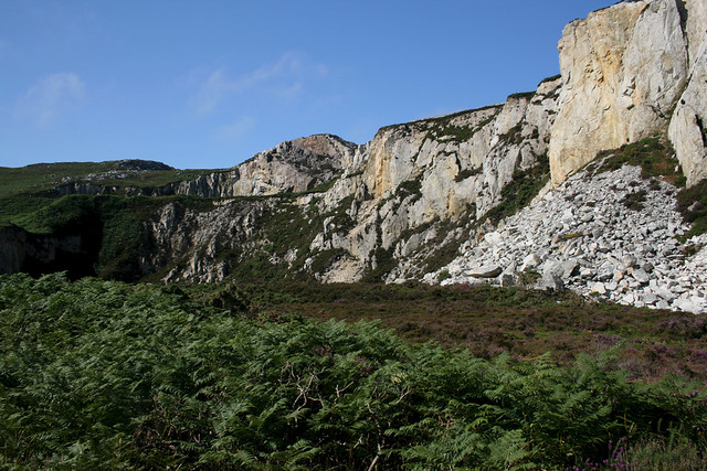
537. Valley to Trearddur Bay

July 2014

This walk completes a circuit of Holy Island, which is another island off the coast of Anglesey (though administratively part of it). I was staying at the Blackthorn Farm camp site so only had a short distance to drive to Trearddur bay where I took a bus to Valley to start the walk, on the “main” island of Anglesey. This is a very short journey as this walk is almost a circuit.

I had had a better night sleep last night which helped. The name Valley I thought a little puzzling, since it seems to be a village named after a geographical feature (I mean we don’t have towns named “Mountain” or “River” or “Forest”, for example).

Despite it’s small size Valley is well served by transport infrastructure with the A55 dual carriageway bypassing it to the south, the A5 going through the centre and even a railway station.

I started from the main shopping precinct, such as it is, near to the A5 and followed the B4545 (Station Road) south, soon passing the railway station on the right and crossing the tracks via the level crossing.

Here I left the road and turned left to enter a recreation ground and followed along the left hand side of this, with the railway on my left. The path soon crosses a little stream then soon after heads into a grim subway under the A55. Then I followed a path beside a man made reservoir of some sort, to join the coast path near Tyddyn-y-cob.

Reservoir in Valley

At the end of this reservoir I joined the official coast path and turned right alongside the marshy land that seperated Anglesey and Holy Island.

The estuary in Valley

The tide is clearly low as it’s mostly mud flats and sand rather than water. The path runs along the edge of fields and beside the marsh yland to reach the small village called Four Mile Bridge.

This is a very grand name and there is a bridge ahead, but it certainly isn’t 4 miles long. It’s about 100 metres long. I think this place got it’s strange name because this used to be the main road and this bridge was 4 miles from Holyhead. It’s now one of 3 bridges that connect Anglesey and Holy Island.

Four Mile Bridge

The view from the bridge is spectacular, looking inland, with this side of the bridge full of incredily calm water.

View from Four Mile Bridge

View from Four Mile Bridge

In the distance I can just make out Holyhead mountain. As I am crossing the bridge I meet a couple walking the other way. They guess correctly guessing I am walking the coast path (as I have a rucksack and am holding a map and camera), they tell me they are here on holiday from Switzerland and also walking this part of the coast path and are enjoying it. They point over to Holyhead Mountain and ask me what that hill is. I tell them it’s Holyhead mountain. They respond with “Pfffft that’s not a mountain”. Well it’s hard to disagree, especially as they have come from a country full of mountains. So I have to explain that whilst I agree it’s not really a mountain that is what it’s called!

The bridge is curious because it’s more a causeway with just a small gap for the water to go through in the middle, and it is certainly rushing through.

Once over the bridge I turned left and followed the coast path, initially a tarmac path it soon drops me down on the foreshore. I’m glad the tide is out, because I am not sure this part of the path would be passable at high tide.

After about half a mile, with intermittent boardwalk the path turns a bit in land, passing some new housing and then reaching a minor road, heading south. Confusingly, the map shows there are two routes of the coast path ahead. One leaves the road after about 500 metres and the other continues on the road ot the next junction. I am not sure why this is until I reach the first path where a sign says this is a permissive path and closed from 1st October to 31st January. I guess therefore the route along the road is the winter route, so  I stick to the summer route, closer to the coast.

The path is quite boggy (perhaps a reason it’s closed in winter) but boardwalks have been provided at many of the boggy parts. The path then enters woodland and comes out onoto a minor track. The coast path follows this but it’s clearly not much used by vehicles with grass growing down the middle and soon narrows to a path that eventually emerges into some nice pine woodland.

Path to Silver Bay

I haven’t seen much of the coast for the last couple of miles, so it is lovely when emerging from this woodland to reach the beautiful beach of Silver Bay.

Silver Bay

Another strange name as I don’t think silver has ever been found here. Anyway I head down onto the lovely sands and turn right to the end of the beach.

Silver Bay

Here the path heads up onto the flat grassland to the south of the beach. Although fairly low lying it’s still quite spectacular as it soon passes lots of little rocky bays.

The coast west of Silver Bay, Anglesey

The coast west of Silver Bay, Anglesey

The coast west of Silver Bay, Anglesey

It’s  a lovely and easy stretch of path and so it doesn’t take me long to reach the beach at
Porth Gorslwyn. It isn’t an especially good beach – shingle, rocks and sea weed, mostly.

Porth Gorslwyn

Porth Gorslwyn

At the end of this narrow beach the path goes around another rocky little headland.

Near Borthwen

The coast is rocky and jagged and the rocks continue out to sea, where I can see some small rocky islands one of which has a lighthouse on it (Rhoscolyn Beacon). I can certainly see why it is needed as this must be quite a dangerous area to navigate in a ship.

Near Borthwen

Soon I reach the next beach at Borthwen.

Near Borthwen

It’s a very pretty sheltered bay. At the far end is what looks like a lifeboat station, though it isn’t marked as such on the map so perhaps it is no longer used as that.

Rhoscolyn

The beach itself at the back of the bay is lovely, a good sandy beach.

Rhoscolyn

Soon I reach the bech and drop down to follow the sands, much nicer than the path behind the beach. There are a few people on the beach but it’s not that busy.

The beach at Rhoscolyn

I stuck with th ecoast path which turns left to reach another little beach, Porth y Corwgl (and misses out walking around the small headland of Ynys Defaid, which has a small tower on it).

Porth y Corwgl

The path now climbs onto more low but jagged cliffs and follows an almost dead straight line. Out to sea there are lovely views of Rhoscolyn Beacon.

Rhoscolyn Beacon

It reminds me a little of Lands End, for some reason. There are a few dry stone walls to cross and sheep grazing in the fields.

Rhoscolyn Beacon

However the flat land doesn’t last for long and the path soon climbs up to just below the top of a hill, Rhoscolyn Beacon. The map shows it as 63 metres high which isn’t very high, but somehow it feels and looks much higher.

Rhoscolyn Beacon


Rhoscolyn Head

This is a wonderful part of the path and I am lucky to again have good weather to enjoy it in. Although the path isn’t right along the shore I am high enough I can still see all the coast and more rocky islands (which all seem to be called Maen y something).

Looking back over Rhoscolyn Beacon I can also see mountains beyond in the distance.

Rhoscolyn Beacon

I think this is the Cambrian mountains but it could be the edge of Snowdownia. Looking ahead I can again see Holyhead mountain in the distance too (but fortunately not the town beyond!).

View from Rhoscolyn Head

View from Rhoscolyn Head

This is a lovely path across what feels quite like moorland and is certainly rugged and beautiful.

View from Rhoscolyn Head

There are soon another couple of deep inlets to my left (I guess this is why the coast path doesn’t follow right along the cliff top here although in theory you could, as the area is marked as open access land).

View from Rhoscolyn Head

Rhoscolyn Head

Having cut this off the path comes out to Porth Gwalch, where the coast path returns to running right along the cliff top (I can already see someone on the path ahead).

Rhoscolyn Head

This is a deep and rocky little bay. The path now climbs onto the headland beyond, Rhoscolyn Head and gives a nice view back.

View from Rhoscolyn Head

View from Rhoscolyn Head

View from Rhoscolyn Head

The view ahead is pretty good too, with a rocky and rugged coast ahead.

Porth Saint

The path runs right along the cliffs here to Porth Saint, another rocky little bay.

Porth Saint

Porth Saint

This coast does remind me a bit of Cornwall, but it seems much less visited. I know very little about geology, but am interested to see all the different colours on the rocks ahead, even a sort of pink and purple colour and I wonder what has caused that.

Porth Saint

The path rounds Port Saint and cuts the next little headland off.

Porth Saint

Porth Saint

The path soon returns to the coast again at Bwa Gwyn. Here there is an unexpected delight, a natural rock arch (strangely, not shown on the map).

Rock arch at Bwa Du

What a beautiful bit of coastline! Beyond this I can now see the first buildings of Trearddur Bay. Although only a village it sprawls along almost 2 miles of coast, around various bays.

Bwa Du

Bwa Du

Bwa Du

This section of coast is stunning, a real unspoilt area of numerous rocky inlets and islands, quite a complicated bit of coast and very beautiful.

Bwa Du

Porth y Garan

Porth y Garan

Porth y Garan

I pass numerous little rocky bays, some have people on and others are deserted and also a few boats moored in the more sheltered bays.

Porth y Garan

This is perhaps my favourite section of the walk. The water here is very clearly with a lovely turquoise colour. Although I can see the buildings of Trearddur are just ahead now.

Porth y Garan

The path goes the landward side of a large caravan park and then joins a minor dead-end road.

Porth y Garan

Porth Castell

This is now the outskirts of Trearddur Bay and I pass a couple of small sandy beaches either side of rocky headlands. The first (above) is Porth Castell then Porth Diana (below).

Porth Diana

Porth Diana

Porth Diana

Both are very pretty, but I think Porth Castell is the better beach.

Porth Diana

Porth Diana

I am soon approaching the main beach of Trearddur Bay ahead.

Trearddur Bay, Isle of Anglesey

This is the best of the beaches, a wide sweep of golden sand.

Trearddur Bay, Isle of Anglesey

Even though it’s the middle of summer and a beautiful day, it’s not that busy. It would be packed if it was in Cornwall!

As soon as I can I leave the road and drop down onto the beach, following the hard sand just below the waves.

Trearddur Bay, Isle of Anglesey

It is a lovely place to end the walk. This was quite a short walk so I stopped here for a late lunch. Then for the afternoon I headed to the other side of the island to visit Beaumaris Castle, which I also very much enjoyed, before heading back to the campsite.

This was a lovely walk, a fairly gentle one for the most part but still with a lot of spectacular scenery. I was glad I did it this way round too as it felt that the scenery just got better and better as the walk progressed. It was a nice mix of cliff top walking and beaches and once again I was very pleasant surprised at how beautiful and spectacular the coast of Anglesey is. I certainly think it would have been a mistake to miss it out!

Here are details of the public transport needed for this walk:-

Arriva Wales route 4 : Llangefni (connection to/from Bangor on route 4A) – Anglesey Airport – Valley – Trearddur Bay – Holyhead. Buses run hourly Monday – Saturday and once every 2 hours on Sunday. It takes a little over 5 minutes to travel between Valley and Trearddur Bay.

Here are the complete set of photos for this walk : Main Link.

Here is a map of the route of this walk:-

Coast Walk 537: Valley to Trearddur bay (Anglesey)


Posted in Anglesey | Tagged , , , , , | 1 Comment

536. Holyhead to Trearddur Bay

July 2014

I didn’t have far to travel for this walk as neither the start or end point was far from the campsite I was staying at. I opted to drive down to Trearddur Bay a short distance away and then took a bus into Holyhead, which only took about 10 minutes. Another reason for doing this walk is I’d start at Holyhead rather than end there!

I started from by the station with a view across the harbour at Holyhead. This is a busy port with ferries to Ireland and traffic to and from the boats goes over the bridge ahead.

Holyhead

I then followed the main road beside the port. In the harbour was one of the Stena Line HSS ferries. These were amazing ships, the fastest high speed ferries in the world when introduced and used to make the crossing to Dún Laoghaire in 99 minutes. Sadly over the years the ferries were slowed down and reduced in frequency (from 5 return trips per day to just one). It was withdrawn from service a couple of months after I took this photo and this route stopped running entirely.

Stena Explorer at Holyhead

These days most of the ferries take over 3 hours from Holyhead! ALthough the fenced off port-road is on my right the area on my left is one of the more attractive parts of Holyhead.

Holyhead

The main A5154 abruptly ends and becomes an unclassified road after the port and the coast path follows this rounding the corner, where the coast begins to become less industrial and more rural, though the port still dominates things.

Holyhead

The path continues along the road to reach the Maritime Museum, which is in an old lifeboat station.

Holyhead

The path leaves the road here to follow along a promenade to a smaller harbour and sailing club, where smaller mostly leisure boats are moored.

Holyhead

Looking to the right though and you can really see the scale of this harbour.

Holyhead Harbour

Beyond this marina area, I come to a muddy sea-weed filled little inlet, which seems partly natural and part man made.

Holyhead

This part of the harbour seems abandonded, I pass a couple of derelict buildings, one of which was clearly once quite grand.

Soldier's Point House, Holyhead

This is known as Soldiers Point House and was a hotel until around the year 2000 and is now derelict and has suffered fires. A shame because it looks as if it would once have been a beautiful building. Holyhead isn’t the nicest town shall we say and this area full of abandonded buildings doesn’t make me feel especially safe so I don’t linger.

The path continues past this ruined hotel to reach the final large breakwater of the harbour and at last becomes more rural, with a flat little headland beyond called Ynys Wellt.

Ynys Wellt near Holyhead.

The path heads around the low cliffs of this little headland and it is nice to be off the tarmac and away from Holyhead now. However looking ahead, I can see the coast is about to get a lot hillier.

Holyhead Mountain

But for now things are fairly gentle and I could look back and see Holyhead now receeding into the distance.

Holyhead

Whilst it is mostly clear and sunny today I can see out at sea there seems to be a bit of sea mist. I’ll be honest I hate that stuff, it is so frustrating if it’s a lovely day to decide to drive to the beach, through glorious sunshine and when you get there find it is cold, dull and damp as the coast is buried in mist, which disappeares just a short distance inland! So I am hoping it is not about to blow in and turn it from a nice sunny day to a grey cold one.

Ynys Wellt, Holyhead

Ynys Wellt, Holyhead

Ahead I can see that the coast is about to get a lot more rugged.

Holyhead Mountain

This is Holyhead mountain although it is certainly not as high as most mountains I think it is called that because the terrain has the feeling of mountain, as it is rocky and craggy like a mountain even if it’s not as high as one.

Holyhead Mountain

At the end of the Holyhead Breakwater Country Park, which is apprantley what this area is known as, the path turns briefly inland and then turns back towards the coast and the climb begins.

Even when very little height has been gained the path already feels a little like a mountain in terms of surface, as it’s now mostly areas of bare rock, with a few grassy areas in between, a bit like walking near the top of a mountain even though I am basically still at sea level.

Holyhead Mountain

Holyhead Mountain

Alhough the map doesn’t show any disused quarries, the cliff face and pile of rocks at the bottom suggest it has been quarried.

Holyhead Mountain

It is a steep climb but the reward is soon a good view back along the coast I have just walked and to Holyhead in the distance.

View from Holyhad mountain

Holyhead mountain

Holyhead Mountain

Although the name Holyhead Mountain implies this is very high it isn’t, the summit is only 220 metres high.

Holyhead Mountain

I soon come across a curious stone shelter. I think this might be part to do with the remains of a pre-historic settlement, although it looks much newer than that.

Stone shelter, Holyhead Mountain

The path continues to wind along the moorland near the summit of the “mountain”.

Holyhead Mountain

Soon I have gained enough height to see back over the harbour. I hadn’t noticed it earlier but the outer harbour wall really is rather odd as it seems to be a in S-shape. Perhaps this helps deflect the waves or makes the wall stronger?

View from Holyhead Mountain

Out to sea, the ferries continue to pass, on their way between Ireland and Wales.

High speed ferries on the Irish See

View from Holyhead Mountain

The path soon starts to descend a little towards the corner where the coast path turns south. This is North Stack and the buildings look much like a lighthouse, except there is no tower or light!

North Stack lighthouse, Anglesey

Although owned by Trinity House I think it was only ever used as a fog signal station and is now disused, at least for that purpose. The view is however spectacular – the coast ahead is certainly rugged.

North Stack, Anglesey

From the lighthouse it is a steep climbs back again.

North Stack Lighthouse, Anglesey

North Stack, Anglesey

However I have soon gained enough height to see another lighthouse ahead. This is the South Stack lighthouse and as you can see the lighthouse itself very much remains here.

South Stack from North Stack, Anglesey

I am nearing the top of Holyhead Mountain here and the views are specacular. I can see all of Holyhead and beyond the tower of the old aluminium works beyond.

View from Holyhead Mountain

The summit of the mountain is only a very short diversion (about 150 metres) from the coast path so I can’t resist diverting off to the summit, marked with a cairn and trig point.

Holyhead Mountain

Holyhead Mountain

Holyhead Mountain

View from Holyhead Mountain

It might not be as high as a real mountain but despite that I can see why it is so named – it does have the feeling of a mountain.

Holyhead Mountain

View from Holyhead Mountain

From the top of course the only way is down and whilst this loses the far reaching views I soon get a lovely view back to North Stack.

North Stack, Anglesey

Holyhead Mountain

Holyhead Mountain

In fact whilst I expected the next bit of path to be all down hill I am soon climbing again to another secondary peak. The sea mist also looks to be coming back in again, which is a shame as I would hate to lose the lovely views I have enjoyed so far.

Holyhead Mountain

However I am soon descending again towards South Stack, which I can see far below.

South Stack, Anglesey

This is on yet another island! Actually the coast path doesn’t go right out to the South Stack island, but there is a path out to it (via a LOT of steps) and of course, I can’t resist taking it.

South Stack, Anglesey

South Stack, Anglesey

South Stack, Anglesey

Actually when I reach the lighthouse I am delighted to disocver that it does open to the public, today is one of the days it opens and I am told a tour started a few seconds ago so after paying my fee, if I hurry up to the top, I can join it. I don’t need asking! I am hurrying up the steps and soon reach the top.

South Stack, Anglesey

South Stack Lighthouse

These are lovely buildings and it is great to see inside one, as so few open to the public.

View from South Stack lighthouse

South Stack Lighthouse, Anglesey

The view does however reveal the cliffs I was just walking are now disppearing in sea mist. I am glad I didn’t set off any later as it would have been such a shame to climb all the way up there and see nothing but cloud.

South Stack Lighthouse, Anglesey

Sadly the tour is soon over and it’s time to head down the tower.

South Stack Lighthouse

South Stack lighthouse

South Stack Lighthouse

The ground floor houses a little museum which I have a quick look around too. I certainly enjoyed looking around this lighthouse. I didn’t think I’d been in there long but coming outsdie the blue skies have now been replaced with white as the mist continues to descend.

South Stack Lighthouse

Even the top of the lighthouse is now almost disspearing into the mist.

South Stack Lighthouse, Anglesey

With the tour now over, I headed back out of the lighthouse and up the many steps back onto the coast path.

South Stack Lighthouse, Anglesey

The cliffs here are amazing and you can really appreciate them from the lighthouse, with all the folds visible.

South Stack Lighthhouse, Anglesey

South Stack Lighthouse, Anglesey

South Stack Lighthouse, Anglesey

The lighthouse itself is soon disappearing in the mist below me as I gain height again.

South Stack Lighthouse, Anglesey

South Stack Lighthouse, Anglesey

I soon pass another white painted tower which I originally assumed was to do with the lighthouse.

Ellin's Tower, South Stack, Anglesey

This is Elin’s Tower and was actually originally built as a folly and uses as a summer house until around 1850. It was later used as a lookout during World War I and II but then became derlict. However it has now been restored and uses as a RPSB information centre.

As I head south from the tower the mist seems to keep coming and going.

Near South Stack, Anglesey

South Stack, Anglesey

However the view changes by the minute and in a minute or so I have a clearer view of the coast ahead.

South Stack, Anglesey

Looking back north, the lighthouse is now visible again, too.

South Stack, Anglesey

The path from Ellin’s Tower soon meets a minor road by the car park. A sign opposite points to some hut circles.

Hut Circles near Ellin's Tower

I can’t see anything marked on the map here so give it a miss (in hindsight probably a mistake). It turns out this is the remains of an ancient settlement and there is actually quite a lot to see. Oh well, something to come back to I guess. From here I have to follow the road for the next 3/4 of a mile or so.

There isn’t masses of traffic but more than I expected – the RSPS reserve and South Stack are popular places to visit.

Soon a neatly and recently mown path means I can leave the road and return to the cliff top.

Coast path near South Stack, Anglesey

Soon I have fine views back over the coast I couldn’t see much of from the road.

The coast near South Stack, Anglesey

Wow, what a stunning section of coast, with several rock stacks and sheer cliffs.

Confusingly, although I have left South Stack lighthouse behind, I re-enter the South Stack Cliffs nature reserve, which seems to occupy two headlands around here. I can hear an engine however and looking back I can see a yellow coast guard helicopter hovering near the South Stack lighthouse.

View back to South Stack

I wondered if it might be Prince William, who was based on Anglesey and I believe flying these helicopters at the time.

The coast here is gnetler and flatter than further north and this part of the nature reserve is more an area of heathland, with the coast path surrounded by heather and some gorse. The path heads west along the cliff top and so I can still see the South Stack Lighthouse in the distance.

South Stack, Anglesey

Although the top of the cliffs are mostly heather and the cliffs are fairly low they are pretty solid granite (I think) cliffs. It is nice to watch the waves crashing into the rocks and hear the sound it makes.

South stack, Anglesey

Further along the cliffs look almost folded, or as if they fell down at some point and are now on their side.

South Stack Anglesey

I soon follow the coast path around the cliffs and am heading east again towards Porth Ruffydd. This is a bay with a large number of inlets cut into the rock presumably by the sea. It is very spectacular.

South Stack, Anglesey

In the distance I can see that the sea mist seems to be blowing in around the South Stack lighthouse again, so I hope it isn’t going to blow this way.

South Stack, Anglesey

The path here is lovely and easy after the more strenous path earlier, mostly a short-grass path over fairly flat cliffs, so I can make more rapid progress now.

Near South Stack, Anglesey

Although there aren’t many people on the coast path I can hear voices. I’m pretty sure they are not in my head. I soon spot the source. Some people “coast-steering” I presume, going along the base of the cliffs.

Near Porth Dafarch, Anglesey

I like being close to the sea, but I am not sure I’d like to be quite that close and it must take a long time to get along the coast this way. Anyway rouding the corner, I soon reach the beach at Porth Rhuffydd.

Porth Ruffydd

It’s quite pretty, but the beach is small and pebble. There is a path going down to it, but I decide to keep to the coast path as I can see there are better beaches ahead, I hope.

The jagged coast line continues, with more rocky inlets to pass.

Near Porth Rhuffyd, Anglesey

Further along there is even a small island, un-named on the map but marked with “fort” so presumably was once considered strategically important enough to defend.

Dinas near Trearddur

This has been a glorious and remote stretch of coast, but I can see civilisation is getting near ahead.

View to Trearddur

This must be the outskirts of Trearddur. This is only a village but it’s rather a sprawling one, stretching along around 2 miles of coastline!

The coast is still pretty rugged, however.

The coast near Trearddur

The path then later drops down to another narrow rocky inlet, called Traeth Marty. There isn’t a beach here, but perhaps there is at low tide. It is a wonderfully peaceful and secluded spot, however.

Traeth Marty

The path climbs away from this inlet and in about 1/4 of a mile I come to a much larger beach, Porth Dafarch.

Porth Dafarch

Suddenly back to civilisation, the beach is quite busy because a road runs along the back and I can see it is lined with cars, campervans and caravans. Still I can see why, it does look a nice beach.

I soon round the corner and reach the road at the back of the beach. Despite the number of cars, the beach itself is quieter than I expected – most of the people seem to be on the concrete promenade at the back of the beach instead for some reason.

Porth Dararch

Soon I can leave the road and continue on the path along the low cliffs on the far side of the beach.

Porth Dafarch, Anglesey

Ahead I can see the coast has become rocky and rugged again.

Near Porth Dafarch

The coast path undulates past more rocky inlets which are spectacular.

Near Trearddur Bay, Anglesey

Near Trearddur Bay, Anglesey

This part of the parth is lovely but short lives, a sI soon heave to join the road again, but this does give a nice view of another beach, Porth y Corwgl. It is a mixture of sand and pebbles but I don’t think there is any public access to the beach, owing to a house behind the beach that I cut out the photo.

Porth Corwgl

The path continues on the road for a few hundred metres to the next beach, Porth-y-post. Unlike the previous beach there is public access to this one as the road runs right along the back of it.

Porth-y-post

Beyond this beach there is a brief section of cliff top path then the coast path returns to the road, which runs the coastal side of a holiday park, with a couple of small rocky beaches in front of the road.

Near Trearddur Bay, Anglesey

The path soon leaves the road again to follow a track passing a large and I think rather spooky looking house, Craig-y-Mor. It is a private house, but Grade II listed.

Craig-y-Mor, Trearddur Bay

Judging by the vans parked outside, they are having work done. The track from the house becomes a sort of promenade behind the next beach, a small rocky beach called Porth y Afon.

Porth y Afon near Trearddur Bay

Porth yr Afon near Trearddur Bay

At the end of this ba the path rejoins the road, passing another rocky beach, Porth Isallt Bach and then reaching the main beach at Trearddur Bay.

Trearddur Bay

This a nice sandy beach, although with some sea weed, so perhaps this is why it’s not as busy as I expected. After sitting on the beach for a while Iheaded to a takeaway in the road behind the beach for an early dinner, it saves trying to prepare food on the campsite, which is only a short drive away.

This was another incredibly varied and spectacular walk. After the industrial and dulness of Holyhead it quickly became spectacular, as I passed (and went to the top) of Holyhead mountain and later on descending down to the wonderful north and south stack and the impressive cliffs. I was thrilled to be able to visit the lighthouse too. Although flatter the coast south of there was also extremely beautiful and rugged and Trearddur bay with it’s lovely sandy beach made a great place to end, it really did feel like a coast walk that had it all. Whilst I stayed in the area, South Stack became a favourite place I came up here sometimes in the evening to escape the noise of the busy campsite.

Here are details of the public transport needed for this walk.

Arriva Wales route 4 : Llangefni (connection to/from Bangor on route 4A) – Anglesey Airport – Valley – Trearddur Bay – Holyhead. Buses run hourly Monday – Saturday and once every 2 hours on Sunday. It takes a little over 20 minutes to travel between Holyhead and Trearddue Bay.

Here are the complete set of photos for this walk : Main Link.

Here is a map of the route of the walk:-

Coast Walk 536 map: Holyhead to Trearddur bay


Posted in Anglesey | Tagged , , , , , , , , | 11 Comments

535. Holyhead to Church Bay

March 2015

This was actually my last walk around the Isle of Anglesey (as usual, I didn’t do the walks in order). Last year I had focussed on the south coast of the island, this year, the north coast. I started from the largest town on the island Holyhead, except it’s actually on a separate island, Holy Island.

I had a nice short drive for this walk, it was less than 10 minutes from the camp-site I was staying at (Blackthorn Farm campsite) to Holyhead. I parked in a car park along Victoria Road just north of the bridge over the road and railway line. I headed up to the bridge and went up the steps across the bridge. I’m not a fan of Holyhead really, it is a run down and rough town, which I was glad to be leaving.

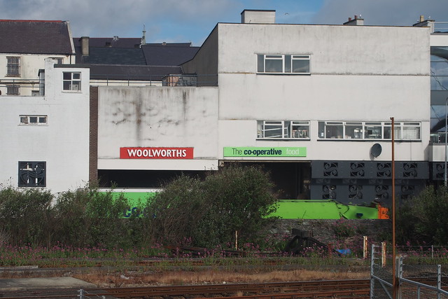
The new bridge gave me a good view over the harbour. Looking back at Holyhead though there was still a large Woolworths sign next to the Co-Op. I think how long the Woolworths sign survived in a town is a good guage of it’s economic success – and there is clearly not much of that in Holyhead. (The chain closed between 2008 and 2009).


Holyhead

The directions from the coast path guide book I was using (the official guide) were not clear. I headed through the railway station and ferry terminal to the road at the front, but could not see the way ahead. I did not want to walk down a dead-end road in the port so I turned right and headed down to the roundabout then turned along the oddly named Turkey Shore Road. This was not a pleasant road either, I found my self squashed in between run-down houses on the right and a stone wall that separated me from the port on the left. I was passed by an ancient bus used as a shuttle bus to the port from the long stay car park. Soon I saw a sign ahead for that car park and begun to worry I was, once again, on a dead-end road. The road soon passed a bit of industry on the right and suddenly after this, there was the welcome coast path sign off to the right, confirming I was on the right route.

This was initially a tarmac path which climbed away from the road, giving me a view over the port area below, where the large Stena Explorer boat was moored up. It had been withdrawn from service at the end of the previous years summer season, but was still here awaiting it’s fate. (These were excellent ferries that used to make the crossing from Holyhead to Dún Laoghaire in 99 minutes, but were withdrawn as they were thirsty on the fuel).

Stena Explorer, Holyhead

The path ran along what I can best describe as waste ground at the edge of the industry, but soon emerged onto a grassy area overlooking the cliffs. I could look out and see one of the large Stena Line ferries just beginning it’s crossing to Ireland. It was nice to be away from the town.

The Wales coast path at Holyhead

This is the area known as Morawelon. The grassy path now ran along the back of the beach which were a mixture of sand, shingle and rocks. At the far end of this little bay was a grassy little island with what looked like an old Martello Tower, or at least the remains of one, on it.

The Wales coast path near Holyhead

I could now continue on the grassy path along the shore line looking towards the hillier parts of Anglesey over the bay. The path was now heading south east and I passed the hospital on the right. Soon though my grassy path joined a cycle path out of Holyhead, which it followed along the back of the beach at Penrhos. This was marked as a sandy beach on the map, but was not as inviting as hoped, it was a grey sort of sand and looked muddy when the tide went out. Ahead was the large chimney of a factory.

The beach at Morawelon, Anglesey

This is the large Aluminium Works on Anglesey which once employed more than 500 people, but was closed down in 2009 – perhaps it is no wonder that Holyhead is run down. (The plant was demolished in 2024).

Penrhos Beach, Anglesey

The beach became more pleasant further on and after a while I dropped down onto the beach for a bit of a variation from the cycle path. At the end of the bay, I could look back over Holyhead, with the mountain behind it.

Penrhos Beach, Anglesey

Penrhos Beach, Anglesey

The coast path now leaves the cycle path behind to head around an area called The Battery, which is closer to the coast.

The path went over dunes and rough grass and passed just below this old battery, but I took the path up to have a look inside it. It was rather neglected, sadly.

Battery east of Penrhos Beach, Anglesey

Returning to the coast path it now continued along the edge of the field right by the coast and soon passed another ruined building, obviously there has been more of a settlement here in the past.

Penrhos Coastal Park, Anglesey

Rounding the corner at Cerrig Adar, there was a good sandy beach to my left, as I was now approaching the water channel between Holy Island and Anglesey.

Penrhos Coastal Park, Anglesey

Looking back the view was now dominated by the mountain behind Holyhead, the town itself now becoming rather smaller below it.

Holyhead

The coast path briefly joined a path coming out of Penrhos and then turned left to explore a little headland. This was really beautiful. The beach here was sandy, the tide was going out and the water was a wonderful blue, with the rest of Angelsey visible on the horizon. I was now in Penrhos Coastal Path and it was lovely.

Penrhos Coastal Park, Anglesey

Penrhos Coastal Park, Anglesey

At the end there was an old stone viewpoint, at least I assume that is what it was.

Penrhos

At the end I turned back with the path to head south west and then south along the eastern coast of Holy Island. The beach was becoming a little muddy now, as I reached the water that separated Holy Island from Anglesey.

Penrhos Coastal Park, Anglesey

Penrhos

Penrhos Coastal Park, Anglesey

At the end of the little peninsula it was back to the cycle path but it was now right along the coast.

Penrhos

I could follow this all the way to the end, where I came to the car park. From here I followed the access road to the bridge that separates Holy Island and Anglesey, Stanley Embankment.

Penrhos Coastal Park, Anglesey

When driving between the two I had barely noticed this as I had stuck to the A55. But this is a wide bridge, more of a causeway really, which carries the A55 dual carriageway, the railway line and the A5 road. I was now following the latter, which was more open than the A55, allowing good views.

However the tide was out and it looked as if you could walk across!

Stanley Embankment

A stone sign mounted into the edge of the pavement gave the distance to Holyhead as 3 miles, but I had walked further than that, following the indentations of the coast.

Stanley Embankment

I was soon passing beneath one of the sluice gates, where the water was flowing rapidly out into the bay, forming a lot of foam.

Stanley Emabnkment, Angelsey

At high tide this is all full of water, but at this state of the tide, there was not that much water, instead it was mostly sand.

Stanley Emabnkment, Angelsey

Soon I was back on the “mainland” of Anglesey having crossed the bridge. Here my coast path gave details of two different routes, a high tide route along the road and a low tide route. I opted for the latter, since it was far more coastal and it was now close to low tide. This ran along the beach, which was mostly shingle and small pebbles so hard-going, but my eye was caught by some of the unusual patterns of the rocks on the beach.

The beach at Valley, Angelsey

Valley, Anglesey

I was now passing the edge of the little community of Valley, but the houses were not right on the coast, so I didn’t notice them much.

The beach at Valley, Angelsey

Estuary near Llanfachraeth, Angelsey

As I headed north the land to my left became marshy as I was now approaching a little estuary. It is surprising to me, at any rate, that the island is big enough for a river to become large enough to form an estuary, but it is.

Estuary near Llanfachraeth, Angelsey

I continued along the beach to a slipway at a little cottage called Penrhyn bach. Here a track cuts off the end of the little spit of land that sticks out into the estuary. At the end the path returned to the coast and followed the edge of a field along the south side of the estuary. Approaching Glantraeth there is a bit another bit of an estuary and a good boardwalk to walk on across the stream.

Estuary near Llanfachraeth, Angelsey

The path then resumed it’s route north along the edge of fields beside the estuary until just before Llanfachraeth there is a new bridge that crosses the river, built for the coast path. Very nice it is too. At the state the tide was, there was now little water in the river but I suspect the land either side is in fact soft mud, so I was very glad for the bridge.

Estuary near Llanfachraeth, Angelsey

Estuary near Llanfachraeth, Angelsey

Once over the river the banks there was much evidence of the river having recently flooded with now dried up bits of sea weed browning on top of the salt marsh.

Near Valley

The path on the north side of the estuary was generally more inland than on the south side, but it had a trick up it’s sleeve first. Initially it is inland, cutting off a little bit of land that sticks out into the river but then briefly dropping down onto the edge of the marsh, not too bad for me as the tide is low but it could be a problem at high tide. Once past this the path heads back inland a little and I turn left on a track. This soon enters a field and the path heads south west over a boggy field. It is briefly back to some marsh at a place called Rabbit Warren and then I head west to joint the coast proper once more. This is beautiful, a sandy beach under a fine blue sky with Holyhead, where I started clearly visible on the other side of the bay. The coast path now runs north along this sandy beach, making for a lovely walk.

Beach west of Llanfachraeth

I passed the remote looking Bodardraeth and continue north on the deserted beach, watching ships coming and going at the busy Holyhead.

Beach west of Llanfachraeth

The lines the waves have made on the sand give the beach a striped appearance, adding to the beauty. After nearly a mile along the beach the coast path heads inland on a road and then forks left on a track to Penial Dowyn. This passes a few buildings and briefly gains a little height in this otherwise flat area, giving a good view of the coast ahead.

Near Penrhyn, Angelsey

I’m soon descending down to the tarmac track behind the beach, leading from the farm, that the coast path now follows around Porth Penrhyn-mawr. The language here is interesting, the place names sound Cornish but I guess that is the Celtic heritage of the area. Once at the beach I dropped down to follow the sands rather than the tarmac coast path.

At the far end of the beach I rejoined the coast path. Here there is a small caravan park (Penrhyn) and I headed past the various buildings along a tarmac track to a march larger caravan park this one at the south end of Porth Tywyn-mawr.

Porth Tywyn-mawr, Angelsey

It was a busy caravan park and I was glad to find a path down to the beach so I could leave it as soon as possible. The coast path again followed behind the beach but since the cliffs are so low (in fact, there aren’t really any cliffs), I stuck to the beach again. The sea was now a beautiful turquoise colour, it was a beautiful beach and a warm sunny day, I was really enjoying it.

Porth Tywyn-mawr, Angelsey

Porth Tywyn-mawr, Angelsey

I soon took my shoes and socks off to walk in the waters edge, very refreshing.

Porth Tywyn-mawr, Angelsey

Once away from the caravan park, I had the north part of the beach to myself too. It reminded me very much of walking the coast in Cornwall, I was loving it.

Porth Tywyn-mawr, Angelsey

At the far end of the beach I could look back to Holyhead and now the mountain behind it was very visible adding to the dramatic scenery, and dwarfing the ferry port below it.

It was a fabulous part of the walk. Near the end of the beach I had to head up through the dunes, not being able to see a way off the beach at the end, to rejoin the coast path. This headed along a track and gained a little height, enough to give me a view back to that great beach.

Porth Tywyn-mawr, Angelsey

The path briefly followed a very minor road past a house on the left and a couple of caravans and dropped me down onto the next beach. This is Porth Trefadog another fine beach, although with a bit more shingle than the previous beach.

Porth Trefadog, Angelsey

Porth Trefadog, Angelsey

I therefore kept my shoes on to walk over this one. At the end of the beach there is a path up to follow right along the edge of the low cliffs. The coast was changing now. Ahead it was becoming hilly again, the beaches were now largely shingle and rock and there were some buildings dotted about.

North of Porth Trefadog, Angelsey

I continued along the back of the shingle beach to Pen-terfyn where there seemed to be a very small harbour, or at least there was 1 boat that had made it’s way here.

North of Porth Trefadog, Angelsey

At the end of the beach the coast path, now a tarmac track, headed a little inland from the coast again and gently uphill.

Although not a busy road it was still good when the path turned off the road and headed left back to the coast, at a little rocky hill. This led to a small and sheltered pebble beach and offered views back over Holyhead, the coast now looking increasingly rugged.

North of Porth Trefadog, Angelsey

Pen-terfyn, Angelsey

Pen-terfyn, Angelsey

I headed around this small hill to reach the next beach, this one Porth Trwyn.

Porth Trwyn, Angelsey

Although marked as sandy on my map, the tide was coming in now and the beach was more shingle than sand. There were some inviting houses and bungalows dotted about seemingly at random above the beach.

Porth Trwyn, Angelsey

The coast path briefly took to the road here but soon forked off along the low cliffs to the north. They might be low, but they were actually cliffs now, the coast was getting a bit more rugged.

The path gained a little height, enough for a sweeping view back around the bay, with Holy Island and the mountain now off to my right.

Porth Trwyn, Angelsey

Porth Trwyn, Angelsey

Porth Trwyn, Angelsey

Ahead the path now began to descend to a little shingle beach with a stream to cross via the bridge. This is Porth Crugmor.

Porth Crugmor, Angelsey

It was a pretty little place, but completely deserted. I was just a short distance away from Church Bay now, my destination, and the coast path headed away and up a little away from the beach, giving a good view back.

Porth Crugmor, Angelsey

The path ahead now went between fields, through gorse and heather and with much higher cliffs ahead.

Near Chrch Bay, Anglesey

Just before Church Bay there was another rocky beach with some unusual cliffs, which looked like they had formed a rocky island, perhaps a part that had broken away years ago?

Porth Crugmor, Angelsey

Soon enough though I was descending to Church Bay.

Church Bay, Angelsey

This was good because it was now around 2:30pm. The last bus from the village of Rhydwyn around a mile away left in around 1 hour. I calculated therefore that I had time for an ice cream and a sit on the beach. It was very welcome! I had a rest for around half an hour and then decided I’d better head inland, as it was an uphill walk and I was now in the heat of the day. I passed the pretty church which presumably gives the bay it’s name, it was quite remote with just a handful of buildings around it.

Church near Church Bay, Angelsey

I continued up the hill to reach the village of Rhydwyn around 15 minutes before the bus was due. I sat down in the bus shelter, but the owner of a nearby house had a dog that started barking every time I moved, it was rather irritating, though he would occasionally tell it to be quiet. I was glad when the bus arrived, although it was around 5 minutes late, and took me back to Holyhead.

Holyhead was not really the sort of place I wanted to hang around, so I drove back to the beach at Porth Dafarch where I spent a couple of hours relaxing on the beach and cliffs above. It had been a lovely walk with some beautiful and very unspoilt beaches and an interesting estuary to walk around. I was glad too I had started from Holyhead, as going this way the walk got better the further along I got! I think it would have been less enjoyable in the other direction.

Here are details of the public transport needed for this walk :-

Lewis Y Llan bus route 61 : Amlwch – Bull Bay – Cemaes – Tregele – Llanhuddlad – Rhdwyn (only some buses) – Llanfaerthlu – Llanfachraeth – Llanynghenedl – Valley – Penrhos – Holyhead. 6 times per day Monday – Friday, 5 times per day on Saturday and no service on Sundays. Note that most buses on the route do not serve Rhdwyn, the nearest place to Church Bay and where I started the walk. Only one bus going south does and 2 going north. Otherwise Llanrhyddlad is the nearest place served by the bus, around a mile further inland of Rhdwyn. It takes around 35 minutes to travel between Rhdwyn and Holyhead.

Here are the complete set of photos for this walk : Main Link.

Here is a map of the route of this walk:-

Coast Walk 535: Holyhead to Church Bay


Posted in Anglesey | Tagged , , , , , , , | 6 Comments

534. Church Bay to Almwch

June 2015

I had a bit of a dilemma planning this walk. I could do a short walk from Almwch to Cemaes or I could, as I wanted to do, try and find a longer route. The problem was a lack of public transport, there are few settlements along the coast between Cemaes and Holyhead and the latter is too far. That means there is also a lack of buses, which is a problem.

In the end I settle for getting a bus to Rhydwyn and walking a little over a mile to Church Bay on the coast. This isn’t perfect as the buses aren’t frequent to there (and less frequent now than they were then), but it means I can do the longer route that I hoped.

I was staying at the Blackthorn Farm campsite and had a much better night sleep than last night now the noisy group that disturbed me last night have left. After a breakfast of a couple of cereal bars and one of those Kellogs mini boxes of cereal I poured the milk straight into, it was time to set off (I don’t think you are supposed to do this, but I didn’t have a bowl).

From here I drove to Amlwch and arrived in time to take a bus to Rhydwyn and from there is was just over a mile walk down to the coast at Church bay, which has a car park and toilets. (Most buses don’t serve Rhydwyn now so you have to do an extra 3/4 of a mile from Llanrhyddlad on the A5025 instead).

I don’t particularly enjoy the walk along the road to get to the coast because the road is narrow with high edges either side, so visibility is poor and there is a fair amount of traffic going to the beach. Church Bay is bigger than I expected, with a couple of cafes, as well as a car park and toilets.

Although the coast path goes along the cliff top, I can’t resist going down onto the largely deserted beach. It is a good sandy beach although it looks like at high tide it’s only rocks and pebbles.

Church Bay, Anglesey

Heading back from the beach there is a little view point by the coast path at the south end of the beach from where I get a look over this beautiful beach.

Church Bay, Anglesey

The path runs right around the back of the beach and looking back I can see another high cliff in the distance, which is Holyhead mountain.

Church Bay, Anglesey

Once up the path around the back of the beach is quite flat but it climbs at the end of the bay through gorse.

The coast near Church Bay, Anglesey

Near Church Bay, Anglesey

Rounding the corner Church Bay goes out of sight but ahead is a small rocky beach, un-named on the map, although there isn’t any sand.

The coast north of Church Bay, Anglesey

At the end of this bay the path keeps to cliff top passing a small cairn and reaching two more small rocky beaches, though the map does names these – Porth y Bribye and Porth y Nant.

Porth y Bribys

The names here do remind me a bit of Cornwall where many beaches also start with the word Porth.

Porth y Bribys

The path descends down and back up passing these bays and there is then a spectacular stretch around a rocky headland (Trwyn y Crewyn).

Porth y Nant

It is more than just the place names that remind me of Cornwall, the coast line also looks quite like Cornwall I thought.

The coast near Carmel Head, Anglesey

The coast near Carmel Head, Anglesey

The coast near Carmel Head, Anglesey

The coast near Carmel Head, Anglesey

After rounding a headland the path descends down to a rocky beach at Treath Ynys y Fddlyn (no idea how to say that). This is another rocky beach but it also has a small tidal island. Although the coast path doesn’t go out to it I can see paths worn into the grass suggesting many people do.

Ynys y Fydlyn

Ynys y Fydlyn

Ynys y Fydlyn

The coast path takes me down onto the beach which although rocky is even more spectacular, with the sea having cut a hole through the rock, which you can’t see from above.

Ynys y Fydlyn

I am tempted, but I have a long way to go today so I reluctantly stick with the official coast path. I stopped for a rest and drink on the beach and even though I was only stopped for 5 minutes the weather has changed quite a bit in that time, with blue sky and sunshine now coming across, which is very welcome.

Ynys y Fydlyn

Now I noticed from the map that for some reason there are two routes of the Isle of Anglesey coast path shown on the map. The coastal route and another that goes along way inland (over a mile) and a lot of it is on roads. I couldn’t work out why anyone would choose that route instead, but the reason is soon apparant.

The coast path ahead is only a permissive path. A sign tells me the coast path ahead is only open from 1st February to 14th September each year (to be fair “only” covers most of the year).

Ynys y Fydlyn

Fortunately I am here in June so I can continue on the coast but something to bear in mind if planning to walk this part of the coast. Oddly the sign looks like it’s National Trust sign (who are usually quite good at allowing public access), so it’s a bit odd that it closes in winter.

Ynys y Fydlyn

Anyway it’s time to get on and it’s a steep climb out of the bay (another reason I wanted to stop for a rest on the beach first), but soon I am rewarded with a fine view back down and and to the north side of the rocky island, which the sea is really crashing into – it is spectacular to watch and lovely to hear the sea even from the cliff top.

Ynys y Fydlyn

Ynys y Fydlyn

Ynys y Fydlyn

It’s another steep climb up into an area that almost feels like moorland, with heather and gorse growing and then a descent back down to another small rocky beach (Porth yr Hwch). Or possibly Porth yr Hwch-fach.

Carmel Head, Anglesey

Carmel Head, Anglesey

Carmel Head, Anglesey

Carmel Head, Anglesey

After this the path climbs higher up onto the headland of Penbrynyreglwys. This gives a lovely view back over the coast I have just walked and soon I am rounding the corner at Carmel Head.

Carmel Head, Anglesey

Carmel Head, Anglesey

This is the north west point of Anglesey although this isn’t quite the last bit of Welsh land, as out to sea I can see some rocks with a lighthouse on it. These are called The Skerries and are I think now a nature reserve although the map also shows a helipad, probably for servicing the lighthouse.

The Skerries, Anglesey

Carmel head has clearly been industrial in the past as I can see an old chimney ahead (also marked on the map) and the map also shows disused shafts, so I presume this was a mining used to take place.

The path soon descends to pass close by the old chimney and too sort of tall trig points beyond. I am not sure what purpose these serve (I have seen mile markers marked like this before but these are much too close together to be that). I presume they are to help with navigation in some way.

Carmel head, Anglesey

Carmel Head, Anglesey

When I round the other side I can see the side facing ships is painted white so yes I assume this is to hep ships navigate in some way.

Carmel Head, Anglesey

Carmel Head, Anglesey

Turning onto the north coast of the island, the coast is just as spectacular though the rocks look darker in colour.

The coast east of Carmel Head, Anglesey

There is soon another rocky beach below the path, though inaccessible other than by boat.

Near Carmel Head, Anglesey

The coast near Carmel Head, Anglesey

Porth yr Ebol, Anglesey

The coast near Carmel head, Anglesey

Carmel head, Anglesey

The path soon climbs onto a hill where I can see further ahead. Although the path has been rural so far I can see a large industrial building in the distance, so I know that it’s not going to stay that way.

Curiously on the hill just in front of this there is a field with LOTS of cows in, not sure I’ve seen quite so many before so I am hoping the path doesn’t have to through that field.

The coast east of Carmel Head, Anglesey

The coast east of Carmel Head, Anglesey

The coast east of Carmel Head, Anglesey

Sadly as I get closer I discover that yes, I do indeed have to through that field but fortunately the cows aren’t bothered and remain where they are. Even this one.

The coast east of Carmel Head, Anglesey

I tried not to get too close in case it tries to back off and falls of the cliff (it didn’t just in case you were worried).

Ahead now the coast is flatter and gently, though the beaches all look rocky and I can see the industry ahead getting slightly closer.

The coast east of Carmel head, Anglesey

The path drops right down to pass a rocky beach and then to a larger bay with the curious name of Hen Borth. For some reason it makes me think Hen Bath and of a farmer trying to wish hens!

Porth Tywodog, Anglesey

Porth Tywodog, Anglesey

I can also see a small church on the cliffs ahead, which turns out to be St Rhwydrys Church. I am not sure why there is a church here because the only settlement is a farm, but maybe it was larger in the past.

Hen Borth, Anglesey

Hen Borth, Anglesey

Hen Borth, Anglesey

There is a small stream heading over the beach (but no problem to cross) and then the path climbs up onto the low cliffs on the far side.

Hen Borth, Anglesey

Hen Borth, Anglesey

Looking back I can see another small rocky island out to sea, with the rather cute name of West Mouse. (Though there doesn’t seem to be an East Mouse).

Hen Borth, Anglesey

It also has a lighthouse on it and I can also still see the larger lighthouse on The Skeeries further out. I know the port of Holyhead is near so a lot of ships come this way so I imagine these lighthouse are quite important to keep the ships away from these rocks.

Near Hen Borth, Anglesey

The path heads up onto the cliffs behind. Whilst a slightly more inland path does head to the church I stuck to the coast path which soon goes around the narrow headland of Trwyn Cemlyn ahead.

Near Cemlyn Bay, Anglesey

Near Cemlyn Bay, Anglesey

Of course I can’t resist heading out to the far end, where the cliffs have lots of groups of “sea pink” growing.

Near Cemlyn Bay, Anglesey

Sadly I can see the industry ahead, which looks like it is at the end of the next bay, Cemlyn Bay.

Cemlyn Bay, Anglesey

Cemlyn Bay, Anglesey

Cemlyn Bay, Anglesey

That beach looks like it’s going to be quite pretty from the map which suggests the path is largely a causeway with a large lake (Cemlyn) behind it. Sadly first impressions are not so good. I assumed this lake is natural but a small but rather ugly dam suggests this is man-made, for some reason.

Cemlyn Bay, Anglesey

There is a bridge over the stream that flows out from this and then the path follows a pebble causeway. It is a bit like a small chesil beach, but hard to walk on.

Cemlyn Bay, Anglesey

Cemlyn Bay, Anglesey

Cemlyn Bay, Anglesey

Walking near the shore I can’t actually see over it, so I head up for a closer look at the lake behind. It is marked as a spot for birdwatching on the map, but I can’t see any birds at all. Perhaps it is the wrong time of year for them, so I head back to the beach.

Cemlyn, Anglesey

Cemlyn Bay, Anglesey

It is a bit of a trudge along the beach but at the far end I can gain a small amount of height and look back over this shingle beach and the lake behind it. Yes it is very much like a small Chesil beach I felt.

Cemlyn Bay, Anglesey

Fortunately the industry does not start immediately and beyond Cemas the path again hugs right along the coast and is spectacular. The unspoilt rocky path, with heather beside it is rather a contrast to the ugly industry beyond.

Porth y Pistyll, Anglesey

Porth y Pistyll, Anglesey

Rounding the corner it’s now right ahead of me. What a contrast to the beautiful coast up until now. This is the Wylfa Nuclear Power station.

Wylfa Head, Anglesey

Wylfa Head, Anglesey

Wylfa Head, Anglesey

It certainly isn’t pretty but there is (or was) an Aluminum works/smelter on Anglesey too and I know that uses a LOT of electricity so I suppose it’s no surprise there is a power station here too. There are two reactors here, however one had been shut down as of 2012. The other was still operating when I did this walk (June 2015) but was also shut down at the end of that year, so the power station no longer operates, although I believe there are plans to open a new one here.

Before I reach the power station there is a small rocky beach, Porth-y-Pistyll. At the end of the beach is what I presume is a small old mill of some sort.

Porth y Pistyll, Anglesey

Porth y Pistyll, Anglesey

The path crosses the stream leading from it and then for a while I have to leave the beach to head around the power station as the coast path goes the landward side of this.

Porth y Pistyll, Anglesey

I presume this is for both security and cooling as I think Nuclear power stations require a large amount of water to cool them and hence are usually built along the coast.

Wylfa Nuclear Power Station

The path heads along a track and through woodland and emerging from this I am pleasantly surprised to find the owners of the power station (I assume) have provided a little view point so I head up to look at the view.

Wylfa Head, Anglesey

If I turn right away from the power station, it’s quite a nice view. Not so much to the left! Fortunately the coast path makes a little loop around Wylfa Head so at least I don’t have to miss out much of the coast. It is a spectacular rocky headland.

Wylfa Head, Anglesey

Wylfa Head, Anglesey

Having rounded that loop I am now heading east again right along the shore towards the large village of Cemaes and Cemaes bay.

Cemaes Bay

Cemaes Bay

I can soon see it ahead, with wind turbines on the cliffs beyond. Before that though there is another small and secluded beach, Porth yr Ogof. Despite the presence of the large power station behind me, looking in this direction it looks quite rural.

Porth yr Ogof

The path descends down towards the bay and from here you can now longer see the power station at all.

Porth yr Ogof

Porth yr Ogof

The beach is beautiful under the now cloudless skies with a little rocky island at the far end too. It is quite unexpected as I hadn’t expected to find such a nice beach right next to this industry.

Porth yr Ogof

Porth yr Ogof

Porth yr Ogof

Porth yr Ogof

The path continues along the low cliffs to another larger beach, Porth Wylfa. This is a pebble beach and also quite beautiful although there is no one on it.

Porth Wylfa, Anglesey

Port Wylfa

Climbing up the cliffs, the height gained means the power station is soon visible ahead again, but at least it is receeding into the distance again. This is another spectacular and beautiful stretch of the coast and I am lucky to have such glorious weather to enjoy it in.

Near Cemaes, Anglesey

Near Cemaes, Anglesey

Near Cemaes, Anglesey

It isn’t far and I have reached the edge of Cemaes.

Cemaes, Anglesey

The path soon joins the road at and promenade at the edge of the beach where I pass an old green navigation buoy (I presume) called Harry Furlong, for some reason!

Cemaes, Anglesey

The first beach at Cemaes is pleasant enough but nothing special but rounding the corner there is a much nicer sandy beach.

Near Cemaes, Anglesey

Despite the fine weather and it being right in the village, there are only 2 people on it.

Cemaes, Anglesey

The path continues on the road at the back of the beach and then comes to the harbour.

Cemaes, Anglesey

Near Cemaes, Anglesey

This is very pretty with the many boats moored up and bunting flying. Well this is where everyone seems to be, sitting on the seat in front of the harbour wall. I am not sure why the prefer the concrete wall to the beach, as it’s not a windy day.

Cemaes, Anglesey

Cemaes, Anglesey

Cemaes, Anglesey

The road crosses the small river that flows into the harbour  and then comes down to another beach. This is Treath Mawr and the map suggests it is another large beach so to be honest I am a little disappointed as I guess that most only be the case at low tide as the tide must be near high tide as there is just a tiny strip of sand below the sea wall, but it is just low enough I can still walk along it. Or at least that was the plan.

Cemaes, Anglesey

Unfortunately, I can see that men are working on the sea wall at the far end. There is a fence across the sea wall and the beach here, going out into the sea. So in fact I can’t get along the beach so I have to follow the road (which is also closed, but there is a gap I can walk through).

At the far end of the beach, passing the road works the path returns to hugging the cliff top and climbs up away from the beach.

Near Cemaes

The geology seems to have changed again. Now there is light grey rock with very square edges.

Near Cemaes

Has it been quarried or is that natural? The map doesn’t show any signs of quarries or industry around here so I assume it’s natural, but it’s quite odd.

Near Cemaes

The hugs the cliffs around more small rocky beaches but soon comes to another larger part sandy beach. This is Porth Padrig and really split into two bays (at least at high tide) with a large rocky outcrop in the middle.

Porth Padrig, Anglesey

Porth Padrig, Anglesey

Porth Padrig, Anglesey

There are steps down to the beach so I can’t resist taking a look.

Porth Padrig, Anglesey

I can follow the beach past this rocky outcrop to the far end of the beach where there is more sand.

Porth Padrig, Anglesey

At the far end there is a little loop around Llanbadrig Point.

Llanbadrig Point

It is a nice easy loop and on the north side I come to another small isolated church.

Llanbadrig Point

It is very pretty and the graveyard is pretty full and yet I again puzzle because it is remote from the village and all else that is here is another farm.

The path beyond here hugs the cliff tops once more and I really do mean hugs, the path is very narrow with a fence on one side and steep, unfenced cliffs to my left. I am glad it is a calm day as I wouldn’t fancy doing this bit on a windy day.

The coast north of Cemaes, Anglesey

The coast north of Cemaes, Anglesey

It is glorious though. The path soon becomes much tougher though as it heads up onto higher cliffs, but it is stunning.

The coast north of Cemaes, Anglesey

The coast north of Cemaes, Anglesey

The coast north of Cemaes, Anglesey

The coast north of Cemaes, Anglesey

It is tough though as it’s up and down and up and down and I’ve done a lot of miles by this point and I am starting to feel tired, although still very much enjoying it. This is quite a tough part to finish with as it soon heads steeply down into another valley.

The coast north of Cemaes, Anglesey

The coast north of Cemaes, Anglesey

This is Porth Llanlleiana with Llanlleiana beyond it. There was clearly once a lot of industry here in the past, but it is abandoned and derelict now.

Llanlleiana, Anglesey

It was once a porcelain work so I imagine this once a busy and noisy place. I find the ruined buildings quite attractive now, as they return to nature. There is a sort of silted up lake behind it all, too.

It’s a long descent into the valley where I can take a closer look at the ruined works.

Port Llanlleiana, Anglesey

Port Llanlleiana, Anglesey

I stopped for a rest on a handy bench here for a while before the steep climb back up the other side. It is very steep.

When I dismissed doing just Amlwch to Cemaes as too short a walk for a day I should have taken a closer look at the map as the countour lines show this is a steep and hilly part of the coast. But wow this bit is particularly steep. When I finally get to the top it looks almost vertical, looking back down to the bay and old porcelain works.

Port Llanlleiana, Anglesey

Port Llanlleiana, Anglesey

Port Llanlleiana, Anglesey

Port Llanlleiana, Anglesey

There are more ruins at the top of the cliff, but these are clearly more recent, I assume from World War II, as this is made of concrete.

Port Llanlleiana, Anglesey

Port Llanlleiana, Anglesey

After that steep climb I am pleased that the path ahead looks easier. It reminds me a bit of the spectacular Exmoor coast now.

Port Llanlleiana, Anglesey

Port Llanlleiana, Anglesey

The path being flatter turns out to be short lived. There is another very steep descent down to Porth Cynfor. All the way down and back up again!

Port Llanlleiana, Anglesey

Port Llanlleiana, Anglesey

It is another steep descent and very steep climb, but as I near the top and stop to catch my breath – well what a view. Stunning. Yes it’s tough but it certainly rewards the effort.

Porth Adfan

Porth Adfan

Porth Adfan

The map again shows old mine shafts and there are clearly the remains of more machinery presumably related to the mines on the cliff top.

Near Port Wen, Anglesey

The cliff path misses out the end of the headland of Torllwyn and then turns south to Porth Wen.

Near Port Wen, Anglesey

This is another interesting place, with quite extensive remains of more old industry here. This turns out to be the former Porth Wen brick works.

Near Port Wen, Anglesey

Right at the end of the industry is what I presume to be a natural rock arch. A shame all the industry was put right next to it, even if it is returning to nature again now. I tried my best to cut it off on the photo below!

Porth Wen, Anglesey

Porth Wen, Anglesey

The coast path doesn’t go right down to this but descends a bit back from it and reaches the shore at the far end of the beach.

Porth Wen, Anglesey

Porth Wen, Anglesey

Again it’s all rather a contrast to the otherwise unspoilt cliffs all around. It looks quite extensive works and yet there is no road here (now) and no village nearby. How did the people that worked here get here? I presume by boat.

Porth Wen, Anglesey

The coast path beyond is magnificent again. Running right along the top of the undulating cliffs, past numerous rocky little coves. It is never flat, but it’s gentler than I have just been over.

Near Porth Wen, Anglesey

Near Porth Wen, Anglesey

Near Porth Wen, Anglesey

There are some narrow little rocky inlets below, impressive how the seat can cut these into the solid looking rocks.

Near Bull Bay, Anglesey

Soon I come over the brow of a hill and ahead is the village of Bull Bay.

Near Bull Bay, Anglesey

Bull Bay, Anglesey

Bull Bay, Anglesey

It’s 5:30pm now so I’ve been walking for nearly 8 hours so far and I have, I estimate, another hour or so to go. Perhaps I planned a rather too long walk today as it was tougher than I realised but there is nothing I can do about it now, I just need to press on to Amlwch.

Usually when there is a town or village on the coast there is a beach or harbour or both. Here there is sort of neither, the coast is all rocky and covered in sea weed here.

Near Bull bay

Near Bull bay

Near Bull bay

It is quite pretty though and the sea is very clear, so I can see right to the bottom. The path joins a minor road but then the A5025 but fortunately it has a pavement and it’s not for long and then I can turn off onto the wide coast path. This is mostly fairly gentle compared with what I’ve been passing but still with pretty rocky bays.

The coast near Amlwch

The coast near Amlwch

Ahead I can soon seen Almwch in sight. An odd mix of bungalows, caravans and industry.

The coast near Amlwch

Sadly there is more industry ahead and there is no access along the shore so I soon have to follow the path inland towards the road. I believe the industry here was copper smelting, chemial processing and bromine extraction. I think it is mostly or all derelict now with the bromine extraction ending in 2004.

I am a bit surprised to stumble across, almost literally, an old railway line that served this industry.

Old railway line at Amlwch

Usually lines are either fenced off or lifted (as the metal can be quite valuable I believe) so I am not sure why neither happened here and it was just left. This was once the Anglesey Central Railway which linked to the mainline railway to Holyhead and Bangor. It closed to passengers in 1964 but continued to be used by freight trains until 1993. There have been various attempts to re-open the line since then, so perhaps the rails have been left in the hope that happens.

Once over the railway it is only a short distance on to Amlwch Port, where I ended my last walk and so joined up to that walk.

Amlwch harbour

P6220423

This was a long and tough walk but an absolutely excellent one too. With the exception of the industry around Wylfa this was a spectacular walk through stunning scenery and shows what a varied coast line Anglesey has from towering cliffs to beautiful sandy beaches. Although the logistics of the walk were a bit tricky it was certainly worth it and the path was excellent hugging the cliff tops almost all of the way. I am certainly glad I decided to include Anglesey in my walk!.

Here are details of the public transport needed for this walk:-

Lewis Y Llan bus route 61 : Amlwch – Bull Bay – Cemaes – Tregele – Llanhuddlad – Rhdwyn (only some buses) – Llanfaerthlu – Llanfachraeth – Llanynghenedl – Valley – Penrhos – Holyhead. 6 times per day Monday – Friday, 5 times per day on Saturday and no service on Sundays. Note that most buses on the route do not serve Rhdwyn, the nearest place to Church Bay and where I started the walk. Only one bus going south does and 2 going north. Otherwise Llanrhyddlad is the nearest place served by the bus, around a mile further inland of Rhdwyn. However you could split the walk into two around Cemaes, which might make things easier.

Here are the complete set of photos for this walk : Main Link.

Here is a map of the route of this walk:-

Coast Walk 534: Church Bay to Amlwch

Posted in Anglesey | Tagged , , , , , , , , , , | 4 Comments

533. Moelfre to Amlwch

June 2015

This was my first full day of a 5 day trip to the Isle of Anglesey. I’m staying at the Blackthorn Farm Campsite near Holyhead. Whilst I don’t usually sleep well the first night of a camping trip this one was particularly bad owing to a large noisy group nearby. I guess I had been pre-warned of sorts when I arrived. When I had arrived, the friendly owner directed me to my pitch by driving a quad bike and telling me follow him in my car. Near my pitch was a large group with lots of chairs set up. I could just about squeeze past them in my car but it was a tight squeeze and they refused to move even an inch. The owner commented when I got to my pitch that “they were very reluctant to move wern’t they?”.

I guess that should have been a warning sign they were very selfish as despite the rules requiring quiet after 11pm (or possibly 10pm) they stayed up until around 2am making lots of noise, so I didn’t get much sleep until then. I was thinking of mentioning this to the owner of the site but I didn’t need to because before I got up he came round and told them to leave due to their behavior. I suspect this hadn’t been the only incident. Fortunately they did, so I guess others must have already complained about them! So I was a bit tired this morning but at least being already on the island I didn’t have to make any long journeys.

After breakfast I set off Amlwch on the north of the island (no idea how you are meant to say it). I parked in a car park near the centre to then wait for the bus to Moelfre, which arrived more or less on time. This also neatly side-stepped the issue of how to pronounce Amlwch as I only had to ask for a ticket to Moelfre instead!

I got off the bus and headed down to the little rocky beach where I left on my previous walk. Thankfully today the weather is much better than it was yesterday, with the forecast for dry and largely sunny weather. The little beach seems to double as a harbour with a few boats pulled up on the shingle.

Moelfre

Moelfre

I followed the road behind the beach and when this turns inland the coast path takes over running right along the shore to an old boat house (possibly the old lifeboat station) then to a monument beside a lifeboat shop, which is called The Royal Charter. It seems to be of some people climbing up walls – not sure what that is all about.

Royal Charter, Moelfre

Just beyond this I come to a much more modern lifeboat station I presume built to replace the on I just walked past. I hope I never need the services of the RNLI but am very grateful they exist.

The life boat station at Moelfre

The path passes this and rounds the corner into a rocky bay. The beach is a mixture of shingle rock and pebbles and off shore is another tiny island.

Eglwys Siglen and the island of  Ynys Moelfre

This is Ynys Moelfre and not inhabited, I don’t think it ever has been (at least, not by humans). It is apparently possible to wade at low tide but I don’t fancy trying and I can see pretty much all there is to see from here I think!

View near Moelfre

However looking beyond the island I can clearly see Puffin Island, which I went on a boat trip around and beyond it the Great Orme, which I have seen for so many of my walks on the North Wales coast.

The path heads out onto a little headland (Eglwys Siglen), running beside the remains of an old wall for a time.

Eglwys Siglen

I enjoyed the views of the Great Orme again from here. The coast path onwards continues to hug the coast along some now almost sheer cliffs (albeit not all that high) to reach another caravan park.

Near Moelfre

There are a lot of those in North Wales! The coast path goes through the edge of this and soon descends down to a another rocky and pebble beach, this one is called Porth Helaeth.

Near Moelfre

Near Moelfre

Beyond this beach there are low rocky cliffs again and soon the path brings me to Porth Forllwyd, a sandy beach.

Porth Forllwyd

This one has a couple of huts at the back of the beach, perhaps used by fisherman. There is a remnant of a harbour at the far end but it looks as if it’s completely silted up with sand now and so is devoid of any boats.

Sadly the coast path goes behind this rather than along the beach but it doesn’t matter because I soon come to an even better beach – Lligwy Bay. It is a lovely beach which stretches for almost a mile and I can’t see a single person on it. This is why I love coastal walking so much, discovering places like this!

Lligwy Bay

Lligwy Bay

Lligwy Bay

I head down onto the beach and follow the firm sand near the waves. Part way along a stream flows out onto the beach (Nant-y-Perfedd). I can see there is a bridge at the back of the beach but near the shore line the water fans out into several small streams so I can easily cross there instead of heading to the back of the beach.

Lligwy Bay

Just after this I have to head to the back of the beach to pick up the coast path from the car park anyway. This is because the path climbs up quite steeply around the west side of the bay but the height gain soon gives me a lovely view back along this glorious beach.

Lligwy Bay

At the end of the beach I pass another rocky beach (Porth y Mor), although there is a little sand near the water line.

Porth y Mor, Anglesey

Traeth yr Ora, Anglesey

The path runs along the back of this beach and soon comes to another glorious sandy beach. This is Traeth yr Ora.

Traeth yr Ora beach, Anglesey

Whilst it does not look like there is much sand at high tide fortunately the tide is low and so there is a large expanse of golden sand – lovely.

Traeth yr Ora, Anglesey

Traeth yr Ora, Anglesey

The official coast path turns inland as soon as you reach the beach, but there is a dead-end path onwards to the beach which I can’t resist taking.

Traeth yr Ora, Anglesey

I stop for a quick rest on the beach then return to the coast path, but pleased to explore another glorious (and largely deserted) beach.

The path now climbs inland to the village of Penrhyn (some of the place names here remind me of Cornwall) and then follows a high path. It is a bit inland but at least I can still see the sea in the distance.

Near Dulas, Anglesey

The path soon passes a small lake, I am not sure if it’s natural or not but mainly seems to exist now to provide drinking water for the cows grazing around it.

Near Dulas, Anglesey

There are also sheep in the same field.

Near Dulas, Anglesey

After passing this the path is descending back to the coast at Traeth Dulas.

Near Dulas, Anglesey

This is a small estuary that flows into Dulas Bay.

Near Dulas, Anglesey

I soon reach the footbridge across the river that flows into the estuary.

Dulas, Anglesey

Having crossed the path turns right back to the coast, running alongside marshes for a time and meeting a minor road, which seems to now serve a small car park as it basically just drops down onto the water and ends.

P6210108

I think it might technically be a tidal road as it later drops down onto the beach.

P6210112

The beach here is a mixture of sand and mud but the coast path doesn’t keep beside it as it sadly soon turns inland at another dead-end road (possibly the other end of the tidal road) and now turns inland heading up hill to the small village of Dulas. For a tiny village (more a hamlet, really) it has quite a large church. The village itself is very scattered about and there is no real village centre.

Dulas, Anglesey

Just after this the path forks off the road, just cutting a small corner to rejoin it at a farm called Plasuchaf, then follows the road for another half a mile.

A road sign warns of red squirrels. Sadly I don’t see any but it’s nice to know they live on Anglesey. After half a mile the path leaves the road (which turns further inland) and eventually returns me to the coast at Porth yr Aber.

Porty yr Aber, Anglesey

Out to sea I can see another small island with what looks like a lighthouse. The map just tells me the island is called Ynys Dulas but just shows “Tower” so I don’t know if it is a lighthouse or not.

Anyway after the diversion inland there is now a glorious section of path that hugs the cliffs ahead.

Near Llaneilian

Ynys Dulas

The coast path near Llaneilian

The path soon turns a little inland and climbs. It is not a steep climb but it is a long climb but that does give a stunning view back. The island with the tower now looks tiny! I assume the tower is some sort of beacon to warn boats of the rocky island.

Near Llaneilian, Anglesey

Zooming in I can see much of the coast of North Wales and Snowdownia behind it.

Near Llaneilian

This lovely part of the path continues for over a mile and soon I am descending towards the headland of Point Lynas or possibly Trwys Eilian (the map shows both names, separated by a /). The path is now a nicely gently descending path towards the lighthouse at the far end of the headland.

Point Lynas

Point Lynas

Point Lynas

The coast here reminds me a bit of Cornwall – it is magnificent. The path ends at the minor road out to the lighthouse at a small rocky beach called Porth Eilian. It is a beautiful little rocky cove.

Porth Eilian

The road to my right winds invitingly towards the lighthouse.

Point Lynas

It’s a dead-end (but is also marked as part of the coast path). The temptation is too much, so yes I head along the road towards the lighthouse.

Heading along the road, to my right is an old jetty not sure what it served as there don’t seem to be any industrial remains here.

P6210149

The road ends beside the lighthouse where the terrain becomes heathland, with heather and gorse. The lighthouse itself is certainly unusual and I can’t think of another I’ve seen like it, as it looks a bit like a white painted castle than a lighthouse. The light itself is, for some reason, at the base of the tower. Which rather makes me wonder why they built a tower at all if the light didn’t go in it!

Point Lynas Lighthouse

Point Lynas Lighthouse

Sadly it’s not open to the public as it’s now self catering holiday cottages. I am not sure if the light itself is still in use.

Returning from the lighthouse I retrace my steps along the road and the path continues along the road after the point I joined it to approach the small village of Llaneilian.

Near Llaneilian, Anglesey

There is access from the road down to the small beach at Porth Eilian and it’s certainly a busy place.

P6210158

Although it’s flying the sea side award flag the beach is mostly pebble – I have passed far nicer (and quieter) beaches already today. However I think many of the people here are going out on boats or have come back from doing so, presumably taking advantage of the sheltered waters.

Porth Eilian

There is however another caravan park just back from the beach so I suspect many of the people on the beach have come from there. From the beach I can leave the road and now take to a path again which hugs the coast once more – another lovely stretch of path.

Near Porth Eilian

The path soon gives fine views back to the lighthouse on Point Lynas. Rounding the corner I come to a rocky bay, Porthyrrychen (again, don’t ask me to say it!).

Porthyrychen, Anglesey

The cliffs around the bay are pretty spectacular, with the waves crashing in.

The coast east of Amlwch, Anglesey

The coast is spectacular and I am pleased that the path runs right along the cliff tops here.

The coast east of Amlwch, Anglesey

The coast east of Amlwch, Anglesey

There are another couple of small rocky coves on the way and soon I can see a few buildings ahead – a sign I am nearly at Amlwch.

The coast east of Amlwch, Anglesey

The coast east of Amlwch, Anglesey

It is a beautiful stretch of coast and coming around the next headland I can indeed see Amlwch ahead.

The coast east of Amlwch, Anglesey

Strictly, this is Amlwch port rather than the village itself. There is quite a lot of heavy industry on the other side of the harbour but I am not sure how much of it is still in use, I think there used to be mining here.

Soon I round the corner into the harbour. I expect it was once busy, but it isn’t now, with just a few fishing boats at one corner.

Amlwch

From here I followed the roads back to the car park and the end of the walk.

This had been an absolutely lovely walk with most of it on excellent paths running right along the coast. The coast had been very varied with plenty of beaches, some large sandy ones and smaller rocky ones, a spectacular headland with a lighthouse and the estuary at Dulas. It was a very enjoyable walk, helped by the fact I had good weather.

Here are details of the public transport needed for this walk:-

Arriva Wales bus route 62. Bangor – Menai Bridge – Pentraeth – Benllech– Moelfre – Penysarn – Amlwch – Cemaes (limited service). Approximately every 45 minutes Monday – Saturday and 6 times per day on Sundays. It takes around 20 minutes to travel between Moelfre and Amlwch.

Here are the complete set of photos for this walk : Main Link.

Here is a map of the route of this walk:-

Coast Walk 533 map

Posted in Anglesey | Tagged , , , , , , , | 4 Comments

251A: Alnmouth to Embleton

June 2026

I’ve already walked the coast of Northumberland so you might be wondering why I’m posting another walk there. Well the simple reason is that I went back there because I enjoyed the Northumberland coast line so much and decided to re-walk this section because last time I did it in heavy rain, at least for much of the walk and today the weather was (a bit) better.

I had travelled up to the North East for a weekend. The previous day I had walked up to the highest point of Northumberland, The Cheviot. If you take the highest point of each county in England, Northumberland is the 2nd highest at 815m (the highest is Scafell Park in Cumbria at 978m).

I was staying at the Ramada Encore hotel in Gateshead. This was mostly a good choice and reasonably priced for the weekend (just over £60 per night). The only downside is that it is clearly mostly targeted at business travelers, so breakfast doesn’t start until 8am at weekends. So I’d got some supplies in my room for breakfast then checked out. I was due to travel on the 08:42 train from Newcastle but it was just over a 20 minute walk to the station from the hotel. This gave me enough time to get lunch from the Sainsbury’s at the station before the train.

I’d booked a ticket because it was a little cheaper to get an “advance” fare than an on the day ticket but this did mean I could choose a seat, so naturally I chose a seat on the right hand side as this is one of my favourite sections of railway line to travel as it runs close to the coast or right along it in places.

It is a less than 30 minute journey and you get a lovely view of Alnmouth as you approach the station. This is the first north bound train of the day and I am surprised how busy it is – glad I reserved a seat. Alnmouth station is actually located in the village of Hipsburn, a similar size to Alnmouth which is a mile away. Despite this the station is called on the signs “Alnmouth for Alnwick”. So the place it’s actually in doesn’t even get a mention!

Anyway from here I head downhill to the roundabout with the A1068 and then continue ahead on the B1338. The map shows the new Kings Charles III England Coast Path (which didn’t exist when I walked this coast previously) as soon joining this road, so it’s a pleasant surprise to find there is actually a path parallel with the road, separated from the road by a hedge, which makes it much more pleasant.

Soon I was reaching the bridge over the river Aln. This is the lowest crossing of the river, which is now widening to an estuary.

Alnmouth Bridge

The bridge itself is a pretty 4 arch stone bridge.

Alnmouth Bridge

Once over the bridge I could turn off the road and follow the path along the landward side of the estuary (Alnmouth is on a little peninsula).

It was clear the tide was out, with extensive mud flats visible.

Alnmouth

The path soon rounds the corner and I drop down onto the sandy beach. There is actually a bridlepath shown as crossing the river here (to the mound opposite) but there is no bridge or even stepping stones and even though the tide looks quite low it isn’t something I’d consider wading across.

Alnmouth

Before I turn around the little peninsula I can see a train passing on the railway line half a mile or so away.

Alnmouth

The coast at Alnmouth

I continued along the beach rounding the corner and now facing the coastal side. Now there is a nice sandy beach and it is popular with dog walkers. This is busy by the standards of Northumberland!

The coast at Alnmouth

There are soon old tank traps at the back of the beach, I assume left from World War II.

The coast at Alnmouth

The coast at Alnmouth

Out to sea I can make out Coquet Island a little to the south.

The coast at Alnmouth

I continue along the beach and although there are areas of rocks, there is a way through (the coast path actually runs at the back of the dunes here).

The coast at Alnmouth

The coast at Alnmouth

The coast at Alnmouth

The coast at Alnmouth

I soon caught up with the couple ahead of me in the photo above who stopped for a chat. They were doing a circular walk, but walking along the coast as far north as Craster before turning inland and had recently moved (I assume retired) to Northumberland. They commented they you don’t see many people carrying a paper map and camera (as I was). Funny that didn’t seem old fashioned when I first walked here, but no everyone (well presumably expect me) seems to use a mobile phone for both navigation and photographs these days.

The beach becomes increasingly pebble, with a difficult but short section over rock but improves a bit as I reach the next bay (I think it’s called Fluke Hole, for some reason).

The coast at Alnmouth

The coast at Alnmouth

The coast at Alnmouth

The coast path runs along the top of the cliffs here I believe.

The coast at Alnmouth

However when I spot steps off the beach onto the coast path I head up onto it because I can see that the water is reaching the cliff at the far end of the bay.

The coast south of Boulmer

The path meanders through a caravan park of sorts with the caravans widely spaced and then when round this I return to the beach.


The coast south of Boulmer

The coast south of Boulmer

The beach is mostly sandy, but with some quite large boulders dotted about in places.

The coast south of Boulmer

Boulmer

This is Boulmer Haven and at the far end of the beach is the small village of Boulmer. I wonder how long the village has left? The houses look very close to the cliff edge and sea defenses look home made and flimsy.

The coast at Boulmer

I was interested to compare how this compared with when I walked this coast before (in 2008) but then I followed the road which is also the official route of the coast path (the Northumberland Coast path did exist then even though the England Coast Path did not). So I didn’t see the backs of the houses.

However a little further up and I rejoined the coast path anyway which follows a byway north from here. The reason being that the beach became very rockly. Alongside the wall beside the byway was this nice artwork.

The coast near Boulmer

The byway was soon right beside the coast again.

The coast near Boulmer

Boulmer

At Longhoughton Steel it is now possible to walk right along the shore line rather than 100 metres or so further inland on the official coast path. Soon I am rounding the corner and can make out the unmistakable sight of Dunstanburgh Castle on the coast in the distance. (It is on the far headland below).

Boulmer

I can soon drop down onto the sands of Howdiemont Sands. At the end there is a little bit of rocky beach before I reach the next beach, Sugar Sands.

Boulmer

Boulmer

However the foreshore gets rocky ahead and so I soon take a path up to the coast path on top of the cliffs. It is a steep (and I suspect unofficial path).

Howdiemont Sands, Northumberland

It is not a huge distance to climb but even this small gain in height gives me a good view back along the coast.

Howdiemont Sands, Northumberland

Soon I am approaching the little valley where the Howick Burn reaches the sea at a little beach called Iron Scars (doesn’t sound very nice), where there is an old concrete structure I can stand on the top of for a good view.

Sugar Sands, Northumberland

It is a sign I am not far from Scotland – I notice streams are already called burns here! There is quite a large bridge over the burn here so I can keep dry feet.

Iron Scars, Longhoughton

Onward now the path leaves the byway and instead there is a narrow and in places a bit overgrown, but well surfaced path right along the cliff tops to Howick Haven and the strangely named Rumbling Kern.

The coast near Howick

The coast near Howick

The shore is a mixture of sandy beaches and areas of rock.

The coast near Howick

The coast near Howick

The coast near Howick

The geology is quite interesting, sometimes there are low cliffs made out of what looks to be a very soft rock (sand stone?) with lines in it.

The coast near Howick

The coast near Howick

The coast near Howick

Further north it soon becomes a gray type of rock again.

The coast near Howick

The coast near Howick

Cullernose Point, Northumberland

Nearing Howick the path runs parallel with the road for a while and this part of the path approaching the road is quite busy – I think it is popular for people to park beside the road and walk this bit of coast path. Soon I am approaching Cullernose Point. This is popular with birdlife and the cliffs show evidence of their “deposits”.

Cullernose Point, Northumberland

I dropped down on the beach away from the path which was a peaceful spot to have lunch undisturbed and watch the birds on the cliffs. After lunch I headed back onto the path ro round Cullernose Point.

Cullernose Point, Northumberland

Cullernose Point, Northumberland

Cullernose Point, Northumberland

The coast near Craster

The path gradually descends to grass where the grass sort of just gradually turns into rocks as it reaches the waters edge.

The coast near Craster

Again I can make out the ruins of Dunstanburgh Castle on the horizon and the village of Craster is just coming into sight too.

The coast near Craster

Swine Den beach, Northumberland

You don’t see Craster until you are almost on top of it, but here it is.

Craster

Craster is quite a nice village, know for smoking kippers. I remember last time along this part of the coast it was torrential rain. Although cloudy today it is nice to see it in the dry.

The coast near Craster

Soon I reach the village centre where smoke comes out the roof of this building. Don’t worry, it’s supposed to it’s one of several smoke houses in the village where fish are smoked. Despite spending so much time by the coast, I am not too keen on eating fish so I don’t linger too long in case I pick up the smell!

Smokehouse, Craster

Soon I reach the pretty harbour of Craster.

Craster

This was the point I ended one walk and started the next (although I extended one to Dunstanburgh Castle and back). I have mixed memories of Craster. Now I have completed walking mainland Britain I can say that this is the ONLY place where I had to resort to a taxi!

Whilst there is a bus service I waited for it at a bus stop where it was listed in the timetable. Craster is at the end of an unclassified road (so in many ways it is surprising it has a bus at all) but all I saw of the bus was it turning around further up the road and driving back out of the village. It turns out the bus stop I was standing at was “out of use”, allegedly for road works (though I did not see any) and the bus company blamed the Council for not having a sign at the bus stop stating this, whilst the Council blamed the bus company. In any case it didn’t help me so I had to call a taxi back to Alnmouth so as not to miss my train.

I am hoping I won’t have to repeat that this time. In fact I can remember at the time there was no mobile phone signal at all here (there still isn’t nearly 20 years after I last walked here) and so I had to use the phone box. But the £1 I had didn’t go very far once I’d called “192” to put me through to a local taxi company (stupidly I let them do this rather than take down the number not realising I was being charged about £1 a minute for it). I remember my £1 ran out before they answered and I had no more change, so had to head to a nearby pub who gave me the number for a taxi and let me use their phone! I can’t remember where the taxi came from now but I was relieved to find out they would come here.

Anyway I was pleased to see the telephone box I used last time I still here even though I didn’t need to use it this time! The harbour was probably once busy but now largely empty.

Craster

Craster

I followed the road behind the harbour and soon left the village behind, going past the English Heritage sign for Dunstanburgh Castle – still a little over a mile away along the road coast but inaccessible by road so you have to walk from either Craster or Embleton.

As a result this part of the path is quite busy since I think the walk between Craster and Dunstaunburgh castle is a popular one.

Dunstanburgh Castle

Dunstanburgh Castle

Soon I had reached the castle and it really is a magnificent ruin.

Dunstanburgh Castle

I thought it might be possible to get along the coast to the east side of the castle but it isn’t because it’s built right into the cliffs!

You can also see the wall of the castle stretches quite some distance along the coast.

View from Dunstanburgh Castle

Anyway having passed the castle a few times, this time I decided to pay it a visit as last time I was here it was after closing time. I’m also not sure if it opens all year around because of the difficult access. However happily today it was open. The gate house is impressive but I was surprised the price of admission was £10 as I wasn’t sure there was much there.

As it happens there was quite a bit more than I realised.

Dunstanburgh Castle

Dunstanburgh Castle

After paying my money in the ticket office (they did have lights and a till there so although remote from any settlement I guess they must have electricity though I suppose it might be generated on-site).

I was pleased to discover that despite the ruined nature of the castle, it was possible to climb most of the way up one of the tower. I was also fascinated by the rooms it was no longer possible to access, with doors opening to sheer drops! (These parts wern’t accessible to the public of course).

Dunstanburgh Castle

Dunstanburgh Castle

From the top I could look at how the castle had been built right to the cliff edge and the foundations of some of the buildings once within the keep.

Dunstanburgh Castle

I could also look back to Craster a mile or so away.

Dunstanburgh Castle

In the other direction I could see the lovely beach at Embleton in the distance but also how large the castle once was. You can see the remains of the outer wall that had a couple of towers along it (which are in ruins). What is not so obvious is the ground drops steeply (almost sheer) behind the wall, so I can see why the castle was built here as there are extensive views in all directions.

Dunstanburgh Castle

Dunstanburgh Castle

Dunstanburgh Castle

Dunstanburgh Castle

Dunstanburgh Castle

I headed down from the tower to explore the rest of the grounds. Whilst much of the land inside the walls is just grass there are the remains of the outer wall all the way around and a couple of towers too.

Dunstanburgh Castle

Dunstanburgh Castle

Dunstanburgh Castle

There are also fine views of the coast from the castle.

Dunstanburgh Castle

Dunstanburgh Castle

I am still in the castle grounds here, but you can see the main gatehouse is quite a distance away!

Dunstanburgh Castle

View from Dunstanburgh Castle

View from Dunstanburgh Castle


View from Dunstanburgh Castle

Zooming in I can see Embleton and the fine beach ahead.

View from Dunstanburgh Castle

View from Dunstanburgh Castle

Whilst ahead is another tower to explore.


Dunstanburgh Castle

Dunstanburgh Castle

Dunstanburgh Castle

Dunstanburgh Castle

Dunstanburgh Castle

Dunstanburgh Castle

Dunstanburgh Castle

Dunstanburgh Castle

I had really enjoyed my visit to the castle. I had wondered if there was enough to justify the admission price and the answer was certainly yes. There was a lot more to see than I expected – the castle was clearly huge and I was pleased to be able to explore so much of the main gatehouse building.

From here I returned and headed back to the coast path which goes the landward side of the castle. You can see the steep hill it’s built on the top of clearly from here.

Dunstanburgh Castle

Now I had another dead line to meet. Today is Sunday and along this part of the coast there are now just 3 buses a day between Berwick-upon-Tweed and Alnwick (the service is more frequent further south), I am sure the service used to be better. So I need to catch the middle one of these in order to get the train I am booked to travel home on.

I definitely have time to get to the next village along the coast Embleton (well the village is actually nearly a mile inland but it’s near the coast), but probably not any further. So that is where I’ll finish today.

Now back along the coast having rounded the castle I can look back to the impressive and near vertical cliffs it is built on top of.

Dunstanburgh Castle

As well as one of the towers. It is such an impressive sight.

Dunstanburgh Castle

The coast path now goes around the edge of  a golf course, I have to wait for golfers at one point. (Actually technically the coas tpath goes a little inland of where I went but I followed a path on the edge of the dunes and the creation of the England Coast Path has declared this area access land, so there is a right to roam anyway).

The path winds it’s way along the coast and down to Embleton Bay. There are fine views back to the castle too. I am glad I visited it!

Dunstanburgh Castle

Dunstanburgh Castle

Soon when the beach becomes sandy rather than rocky, I drop down onto the beach again.

Embleton Bay, Northumberland

Embleton Bay, Northumberland

Embleton Bay, Northumberland

Initially it is a mixture of sand and rock, but soon it becomes a wonderful sandy beach, backed by dunes.

Embleton Bay, Northumberland

I have about 20 minutes to spare, so I enjoy a sit down and rest on the soft sand by the dunes – it is a lovely beach here and a great place to spend some time enjoying it.

Embleton Bay, Northumberland

Dunstanburgh Castle from Embleton Bay

Embleton Bay, Northumberland

Embleton Bay, Northumberland

Dunstanburgh Castle from Embleton Bay

The coast of Northumberland is known for it’s beaches and castles and here I have the classic combination side-by-side.

Embleton Bay, Northumberland

Embleton Bay, Northumberland

Embleton Bay, Northumberland

Embleton Bay, Northumberland

Sadly it is soon time to head inland to catch the bus. The path goes past the dunes and part of the golf course to reach the club house and the end of the road. The road is lined by cars because the car park is I think private and for the golf course only.

Fortunately the road has a path parallel with it and again separated from a hedge from the road so I don’t have to dodge the traffic as I had expected to be doing. The road is uphill all the way however although not that steep and in about a mile I emerge from the path back onto the road into the centre of the village.

Fortunately I have checked on my phone here where the bus stop is, as it’s a bit north of the village centre. I head to it and am about 10 minutes before the bus is due. Well I didn’t know exactly how long the walk will take.

I had checked last night at the hotel on my phone the bus times and used Google to tell me which train to get back to get me back to Newcastle on time. I am booked on specific trains south from Newcastle back to London so I can’t afford to miss it or I’ll need to buy a new (very expensive) ticket.

So I had booked on the 16:29 train from Alnmouth to Newcastle. This gives me pretty much exactly an hour before the train home (which I plan to use to get a meal) as not all that many trains stop at Alnmouth station. It is a small village after all so it’s quite a surprise that not only does it have a station but has direct train to both London and Edinburgh.

However whilst I am consulting the timetable displayed at the bus stop I realise an issue. I booked the train at 16:29 which Google though I had plenty of time to catch. I am waiting for the 15:31 bus. However checking the timetable, the bus gets to Alnmouth station at 16:35. That is 6 minutes after the train I need to be on. More worryingly the next train means I miss my train home from Newcastle. Stupid me I should have double checked what Google Map was telling me at the hotel last night. I was worrying I was going to have a repeat of my last walk along this part of the coast and have to call for a taxi again!

However I am struggling to get a mobile signal but eventually manage to and get Google to show me the times it thinks. Ah ha! Now I see what is going on.

The bus goes from here to Alnwick bus station, then waits there for 10 minutes before heading to Alnmouth station. It turns out that to get to Alnwick it goes to Lesbury first then on to Alnwick. What Google is telling me to do is to get off here and walk from here to Alnmouth station. It’s about half a mile from the last bus stop in Lesbury along the A1068 to Hisburn and Alnmouth station.

I should have checked the directions Google was giving me more carefully last night as I knew the bus did stop at the station so I assumed that was the route. Instead because of the time it takes to get to Alnwick, then wait 10 minutes and basically come back again, it is much quicker to get off and walk that part of the route, which is what it’s telling me to do. So that’s a relief – I can make my train!

The bus turns up about 5 minutes late but fortunately the useful “bustimes.org” website shows me a map with the live location of the bus, so I know this. When we get to Lesbury a large number of passengers, many with suitcases also get off. It seems this trick of getting to Alnnouth station earlier is well know as they are all heading there!

In the end I need not have worried because I got to the station nearly 15 minutes before the train so that worked out well. I again booked a window seat on the left side for the train back to Newcastle so enjoyed the views of some of the coast on the way back.

The train was on time and going to London but I got off in Newcastle. I had about an hour to wait here so used the time to go to the Mile Castle Whetherspoon pub just a few minutes walk away. I know these places aren’t to everyones taste, but there are 3 floors so plenty of space and a good choice of cheap food. I know they usually serve quickly too, as turns out to be the case here. So I manage to get a full meal and a pint before heading back to the station for my train home.

I hadn’t clocked it at the time but I booked a slightly slower train because it was about £10 cheaper but it required me to change. Checking again a few days ago it seems I am booked to travel on a Transpennine Express train as far as York, then a Grand Central train (which has come from Sunderland) from there to London, rather than LNER who run most of the trains. There is only 10 minutes to connect in York so I hope I make it.

The first train arrived on time but got slightly delayed but I still have just over 5 minutes to change by the time I reach York and it is the next platform so I make the connection fine. The train from York to London is I think completely full so I am glad I got a reserved seat. The trains Grand Central use are older but actually much more comfortable (the LNER trains have rock hard seats) so it is quite a pleasant journey back to London where I arrive on time. From there it’s back on the tube to London Waterloo for the train home.

There I discover there is engineering works on (of course … it’s Sunday). This means whilst I have a direct train service home still it takes more than twice as long (a little over an hour) and runs less often because the trains are diverting via Richmond and Chertsey instead. Still at least it’s not a replacement bus! At least everything had gone according to schedule too.

Overall this had been a very enjoyable day and it was nice to re-visit an area of coast I loved before but hadn’t been to for nearly 20 years (gosh was it that long ago!) and one that I saw in very poor weather before. Whilst it wasn’t wall to wall sunshine today either (mostly overcast but dry) it had been much better. I also really enjoyed the visit to Dunstanburgh Castle and was glad I hade made the effort to include it this time. I passed so many places on the coast I vowed to come back to so it’s nice to actually do that for once!

Here are details of the public transport needed for this walk:-

Arriva buses route X18: Berwick-upon-Tweed – Scremerston- Haggerston – Beal – Belford – Warren Mill – Bamburgh – North Sunderland – Seahouses – Beadnell – Embleton – Craster – Longhoughton – Alnwick – Alnmouth – Warkworth – Amble – Broomhill – Widdrington Station – Pegswood – Morpeth – Regent Centre – Newcastle-upon-Tyne.  In addition Alnmouth station is served on Sundays. 4 buses per day Monday – Saturday between Embleton and Alnmouth (the service is more frequent south of Alnwick) and 3 buses per day on Sundays. It takes around an hour to get between Embleton and Alnmouth directly because the bus goes to Alnwick and back on the way.

Here are the complete set of photos for this walk : Main Link.

Posted in Northumberland | Tagged , , , , , , , | 4 Comments

532. Moelfre to Pentraeth

July 2014

Rather confusingly, the previous walk along the coast (as opposed to the boat trip to Puffin Island), I was starting the day at home. Today was the same, but a year earlier! I didn’t do the walks on this part of the coast in order as you can see and today I had a short walk planned after I made the long drive up from home, which was close to the A55, so I wouldn’t have to go far out of my way.

The drive went well until I got around Birmingham where I got stuck in traffic (this always seems to happen if you go near Birmingham) but after that I had a fairly clear run the rest of the way and arrived at Moelfre a little later than planned. I hoped this would give me enough time to catch the bus at the end of the walk back to Moelfre, as I was camping for this trip and hence needed to check into the campsite by 6pm.

I was staying at the Blackthorn Farm Campsite. (Which has since changed hands and becomes MUCH more expensive than it was when I stayed).

There had been rain for much of the journey and unfortunately it hadn’t yet stopped, it was raining quite hard, but having to plan these trips in advance, I have to take the weather as it comes.

Moelfre

Moelfre

The walk starts off on the road, passing the Kinmel Arms and then soon after when the road turns inland the path begins, passing through gorse and bracken to reach the small pebble beach at Porth yr Aber.

Moelfre

Near Moelfre

From here I have to turn a bit inland to follow tracks around a farm (which also includes a campsite). Unfortunately the rain soon proves too much for my camera and I have to put it away in my bag for a time so there aren’t any photos for the next mile or so. The path returns to the coast above a small harbour and slipway at Traeth Bychan. This consists of a small beach and sailing club but is surrounded by caravan parks. I bet the beach gets crowded on a good day – but no chance of that today!

Near Moelfre

At low tide it is possible I think to continue around on the beach to Dinas Beach, but sadly the tide is in so I have to take the inland route behind one of these caravan sites to reach the back of the beach at Treath. This is a much larger beach but given the weather there are few people here. It is much more rural however with no caravan parks directly behind the beach at least.

The coast path now heads through another caravan park to the headland at Penrhyn and from there returns to hug the coast south towards Red Wharf Bay.

Near Moelfre

Near Moelfre

This is a lovely part of the path as it is well maintained and runs right along the cliff top. Also as you will see the rain has by now stopped and although it’s cloudy it is at least dry now, so the photos can resume. However my camera is still suffering a bit with the rain as the lens had steamed up a bit inside so apologies some of the following pictures have a few blurry areas because of this.

Soon the next village, Benllech is coming into view and I can see there are more caravans ahead.

Near Moelfre

The path fortunately skirts most of them, but the first field is touring caravans and motorhomes whilst later the path runs alongside what must be hundreds of static caravans although the path is separated from them by a hedge. Nenllech must be a popular place to holiday.

The coast near Benllech

The path soon descends down from the path onto the road at the back of the beach.

Benllech

The weather has continued to improve – by now the sun has come out and the sky is turning blue. I am so glad the whole walk isn’t going to be in rain. There is beach here at low tide but it must be near high tide as the sea is right against the sea wall, but further along the sand begins.

Benllech

It is a lovely beach and although the weather has improved I guess the rain this morning has put people off visiting the beach as it’s practically deserted.

The path soon passes a car park and then turns inland briefly.

Benllech

Benllech

Benllech

Benllech

Again if the tide was low I think I could continue on the beach here but as it isn’t I have to follow the road as it turns away from the beach and heads inland but only for a short distance as a track (and the coast path) soon turns off, to run beside the beach again, climbing away from the beach a bit but this gives views back around the bay. I can see  just how many caravans there are here, they aren’t pretty.

Benllech

The path soon descends back down to the beach again.

Benllech

Benllech

However it’s soon a gentle climb back out.

Benllech

Benllech

Sadly the path soon turns a little inland to pass what the map shows are disused quarries. The map lies. Maybe they were quarries once but now it is more caravan parks. As I said, caravan holidays certainly seem to be popular in this part of Wales.

Once round these the path returns to the coast again at Red Wharf Bay.

Red Wharf Bay

Again there is no much beach here due to the tide but the path follows a pleasant promenade just above the beach.

Red Wharf Bay

There is a small spit of land here and a harbour behind it, presumably the spit meaning the water behind is much more sheltered. This is Pentreath New Quay I believe.

Red Wharf Bay

At low tide this is an area of sand and mud flats but today the tide is right up to the back of the beach.

Red Wharf Bay

Fortunately the path runs just in the edge of the marsh, a gravel path just beside a low wall so despite appearances I don’t have to get wet feet.

Red Wharf Bay

Red Wharf Bay

The back of the beach is mostly mud flats.

Red Wharf Bay

I am glad I saw it at high tide, it is much prettier to see the water than acres of mud!

Red Wharf Bay

Red Wharf Bay

I soon reach the point I need to turn inland to Pentraeth to get a bus back to Moelfre. Although I am leaving the coast now, there are still nice views of the rolling countryside around the village.

Near Pentraeth

Once I reached the village I only had about 10 minutes to wait for a bus back to Moelfre. This got me back in time to get to my car in time to drive to the campsite to reach there by 6pm. I was met by a friendly man who showed me to my pitch. I was glad that it had stopped raining by now so I could set the tent up in the rain.

After doing battle with the tent I eventually got it put up and then set about cooking dinner, which was a pie, tinned potatoes and bakes beans as I had limited cooking facilities!

This had been a lovely introduction to the Isle of Anglesey, with a mixture of cliff top paths and pleasant beaches. Although the rain did spoil the first part a bit it was nice to finish in sunshine and see the coast at it’s best with the tide in. I was also looking forward to doing a full days walk tomorrow rather than the short walk today.

Here are details of the public transport needed for this walk:-

Arriva Wales route 62. Bangor – Menai Bridge – PentraethBenllech– Moelfre – Penysarn – Amlwch – Cemaes (limited service). Approximately every 45 minutes Monday – Saturday and 6 times per day on Sundays. It takes a little over 15 minutes to travel between Pentraeth and Moelfre.

Here are the complete set of photos for this walk: Main Link.

Here is a map of the route of this walk:-

Coast Walk 532: Moelfre to Pentraeth


Posted in Anglesey | Tagged , , , , , , , | 2 Comments

531. Puffin Island

June 2015

Yesterday I’d seen Puffin Island from a far on the Anglesey coast path. Today I was going for a closer look.

Unfortunately public access to the island isn’t permitted as it’s a nature reserve. However it is still possible to get closer to the island because a company called Seacoast Safaris offer a tour around the island. This allows you to get much closer to the island and, hopefully, see some of the wonderful wildlife that lives there and in the waters around it. If I couldn’t walk around it, this would be the next best thing! So whilst this isn’t really a walk it does at least show a bit of the coast I otherwise wouldn’t have seen.

I had done another walk along the coast this morning. I had made it a shorter walk so I would have time to fit in this boat trip later in the day too. So it was a fairly short drive around the coast from where I ended that walk to pretty Beaumaris. I parked in the main car park a short distance from the pier from where the boat would go.

I soon saw the boat approaching from an earlier tour and soon it was time to get on board. I had got lucky with the weather as it was clear and sunny. I suspect as most of the seating on the boat is outside it either gets very crowded or you get wet if it’s raining!

We are soon underway and heading out of the Menai Straight into Conwy Bay. The captain soon welcomes us aboard and tells us his son who will be going to University in the autumn is also helping out and tells him to come around and “meet us all”. This means he comes round to chat to everyone on the boat and so when it’s my turn he wants to know what I am doing during my stay here so I tell him about I am walking the coast of Anglesey and tell him that I went to University and enjoyed it and hope he does too. He seems happy with this and goes to talk to someone else. To be honest I was here to see the scenery and wildlife and not too interested in making small talk with the captains son!

Out to sea I can, once again, see something familiar. The Great Orme. This is a feature of the landscape I’ve been able to see for most of my walks on the North Wales Coast.

The Great Orme from Conwy Bay

Closer to shore are the hills and mountains at the edge of Snowdonia, behind Penmaenmawr and Llanfairfechan.

The North Wales Coast

The North Wales Coast

Whilst inland views of this grand building on the shore in Beaumaris.

Beaumaris

The water is initially quite calm as we are in the sheltered waters of the Menai Strait but it gets a bit more choppy as we head further out.

Boat trip to Puffin Island

The North Wales Coast

Soon however the waters calm again as the boat follows close alongside the shore of Anglesey where I walked on my last walk.

The North Wales Coast

Conwy Bay

Conwy Bay

Whichever way you look there are beautiful views.

Conwy Bay

Conwy Bay

Conwy Bay

The cliffs of this part of Anglesey look very interesting. For the parts of the coast path on paths (most of it), you don’t always notices the cliffs you are walking on top of, but they are beautiful here and clearly quite soft with many caves visible at the base of the low cliffs.

The Isle of Anglesey from Conwy Bay

Continuing up the coast the boat soon passes Penmon and the ruined buildings which I think were once a working quarry and associated port, now derelict and roofless.

Llangoed, Anglesey

Most of the houses are too, but  a couple still looked lived in.

Llangoed, Anglesey

Llangoed, Anglesey

Soon the purpose of this trip is coming into view – Puffin Island.

Puffin Island

The boat now passes the sea ward side of the pretty Trwyn Du Lighthouse. At the time a bell was run every 30 seconds, but sadly this has since been removed.

Trwyn Du Lighthouse, Anglesey

Conwy Bay

Puffin Island, Anglesey

The cliffs of Puffin island are made of solid rock (granite?). Some of it look quite square shaped so I am not sure if it has also been quarried in the past, though the map doesn’t show any former quarries.

Puffin Island, Anglesey

Soon I am delighted to see one of the birds that gives the island it’s name – puffins. Here it is flying just above the water.

Puffin at Puffin Island, Anglesey

Puffins can generally only be seen on land during a few months in the summer as they nest and breed on land but live for the rest of the year at sea, so I have timed this trip well. They are beautiful birds.

Soon there are a number of them bobbing about on the waves.

Puffins at Puffin Island, Anglesey

It is lovely to watch them. Still on the cliffs of Puffin Island there are many birds and these aren’t puffins, they are Cormorants as despite the name, Puffin Island is more famous for it’s colony of Cormorants.

Pufin Island, Anglesey

As the boat gets closer I can soon see just how many there are. They seem packed onto every ledge! It is a wonder they don’t fall off (or perhaps they do, they can fly I guess).

Cormorants, Puffin Island, Anglesey

Cormorants, Puffin Island, Anglesey

Cormorants, Puffin Island, Anglesey

The birds seem to be on more or less every cliff around the island.

Puffin Island, Anglesey

There is also the remains of a building on the island. Although uninhabited now in the past there was a monastery here and this is the remains of it. I am not clear when it stopped being used but records show it was in use around the 12th Century. Parts of it had a house built over it in the 19th Century, so clearly the island has also been inhabited more recently.

Further up there is also the remains of a much later signal station, though this is also now disused.

Puffin Island, Anglesey

The cliffs are fascinating I assume volcanic with diagonal lines on this part of the island.

Puffin Island, Anglesey

The remains of the Telegraph Station can also now be seen on the cliff top now we are at the northern end of the island.

Puffin Island, Anglesey

It is not just bird life the island is famous for, there are also seals in the water around the island too. We saw a few but they are quite hard to photograph (at least, that’s my excuse) as they keep diving under the water but you can see one here just below the centre.

Seal of Puffin Island, Puffin Island, Anglesey

Looking back to the island, there is now a better view of the very derelict old Telegraph station. I suspect this has been disused since World War II.

Puffin Island, Anglesey

Puffin Island, Anglesey

Puffin Island, Anglesey

Puffin Island, Anglesey

The boat continues around the west side of the island where again the rocks look a little different.

Puffin Island, Anglesey

There are also patches of red in the rocks (iron, I presume).

Puffin Island, Anglesey

Sadly, it is now nearing the end of the trip and time to head back to Beaumaris.

Puffin Island, Anglesey

The sea gulls seem to like flying alongside the boat as we go.

Conwy Bay

Trwyn Du Lighthouse, Anglesey

Llangoed, Anglesey

Puffin Island

Whilst there wasn’t very much (well any, really) walking involved on this trip, I loved seeing the island close up and was very lucky to see so much wildlife. I might not have been able to walk around it (for obvious reasons) but at least I’d seen all the coast, and the remains of the buildings that were on the island from the sea. It is lovely to see the cliffs packed full of nesting birds so I can see why access is not allowed. I certainly recommend the trip.

Seacoast Safaris run regular trips around the island during the summer months (and other trips too) and is the company I used for this trip.

Posted in Anglesey | Tagged , , , , , | Leave a comment

530. Penmon to Pentraeth

June 2015

My last walk which took me onto Anglesey I did as a day trip from home. However now it’s got a bit far for that, so on this trip I am staying on Anglesey. However this is a 5 day (4 night) trip and this is my first day, which means driving from home in Surrey to Anglesey. Hence this walk is short as I first had to drive from home.

The journey was mostly OK apart from a bad traffic jam around Birmingham (as far as I can tell it’s impossible not to get stuck in a traffic jam if you try and use any of the motorways around Birmingham). I drove to Pentraeth and then took a bus to Menai Bridge and another to Penmon. After all this it was around 1:30pm so I was keen to get walking!

As the bus dropped me in Llangoed (as near as I could get to Penmon at this time of day), I followed the road back to the coast to reach Cynlais Beach.

Cynlais Beach near Penmon, Anglesey

Around the corner was another beach, un-named on the map I assume it’s Penmon beach.

Porth Penmon, Anglesey

The coast path here follows the road round Porth Penmon and then passes the remains of the priory that I saw last time. The remains of the priory are quite large and extensive, though I didn’t stop to look around. That was because I have a deadline to get to the campsite I am staying tonight for 6pm as you are meant to check in by then, so I don’t want to dawdle, but it’s a shame it is probably well worth seeing.

Penmon Priory, Anglesey

Penmon Priory, Anglesey

Penmon Priory, Anglesey

Penmon Priory, Anglesey

The road I am on is a dead-end (for cars) that leads to a car park at Penmon Point, overlooking Puffin Island. Soon I come over the brow of the hill and can see the end of the road ahead. I can see all of Puffin Island ahead, although I am looking at it’s narrower side. It is not possible to visit the island as it’s a nature reserve and public landing is not permitted, so I won’t be able to walk around it, but at least I can see it from here.

Puffin Island off Anglesey

The car park at the end of the road is quite busy and I notice most of the vehicles are motorhomes and campervans. I suspect a popular overnight stop. At the end of the road there is also a cafe but I’ve had lunch by this point and again pressed for time.

Penmon Point, Anglesey

So I head down to the beach to look across to Puffin Island.

Puffin Island off Anglesey

Puffin Island off Anglesey

There is also a lighthouse here called Trwyn Du (or often just Penmon Lighthouse). Curiously at the time a bell sounded from the lighthouse every 30 seconds! This was a warning signal and I believe the last lighthouse in Wales to have a warning bell, but it was controversially replaced by a conventional fog horn in 2020.

The beach is pebble but more or less a ridge, it slopes away at the landward side too. It is a lovely spot.

Penmon Point, Anglesey

From the lighthouse the path almost doubles back on itself parallel and north of the road over heathland and then alongside an old stone wall. I suspect this to be connected in some way with the ruins of the Priory at Penmon.

Near Penmon, Anglesey

Near Penmon, Anglesey

Road sections are often quite easy, but this one sends me higher and higher up hills.

Near Penmon, Anglesey

Near Penmon, Anglesey

The path is about half a mile inland from the sea however and soon joins the road through the small village of Caim. The road here is so narrow it is about as wide as a car and twisty with a high hedge on both sides. So I am hoping not to meet any traffic coming the other way as there is no room to pass. Fortunately that doesn’t happen and the path soon meets the (slightly) larger road at a junction.

However after only a short distance the Wales Coast Path turns off to the right through Plan Newydd. It is nice to be off the road, but the path is quite fiddly, I seem to be constantly having to through gates or over stiles and check directions. Inland a windmill is marked, but I can see that it no longer has the sails.

Near Penmon, Anglesey

After numerous twists and turns it rejoins the road about half a mile further along again to pass Glan-yr-afon.

Near Penmon, Anglesey

Despite the distance, I can still see the Great Orme in the distance, and Puffin Island in the foreground.

Near Penmon, Anglesey

The road passes the Mariandyrys Nature Reserve and then heads north on a path finally back towards the coast again.

Near Penmon, Anglesey

Near Glan-yr-afon, Anglesey

Near Glan-yr-afon, Anglesey

The last part is a pleasant path over heathland (Fedw Fawr).

Near Glan-yr-afon, Anglesey

I soon come across horses grazing on the heathland ahead of me. They are a little frisky but most of them move out of the way as I approach.

Near Glan-yr-afon, Anglesey

Unfortunately ahead is a mother with a foal. The foal goes running off along the coast path ahead of me.

Near Glan-yr-afon, Anglesey

I therefore headed back and took the upper path the white horse was on. This caused it to head back and the foal to run back. Mother and baby re-united.

Near Glan-yr-afon, Anglesey

So after that little drama, I continue on the nice coast path over the heathland along the coast, which runs for a mile or so and then emerges at the large Llanddona Beach.

Llanddona Beach, Anglesey

The coast path soon joins a minor road that runs along the back of the beach. I ignore it and follow the beach instead.

Llanddona Beach, Anglesey

It is a mixture oif pebbles and shingle, but as I head further west the shingle turns into pebbles, but fortunately there is (just) a line of firm sand at the waters edge.

Llanddona Beach, Anglesey

Later on this becomes much wider.

Llanddona Beach, Anglesey

Llanddona Beach, Anglesey

Llanddona Beach, Anglesey

It is a lovely walk along this huge beach. However as I head west the beach turns from sand to marsh. So I rejoin the official path that runs through this marshland. Mostly it is a grass path, boggy in places, but in the worst places there are small sections of board walk. However ahead the path changes and follows a narrow fenced in concrete path over the marsh. this is good for keeping my feet dry, but not so good if you meet someone coming the other way. I did, but fortunately only one.

The Wales Coast path near Red Wharf Bay

Later on the path reverts to boardwalk through more reeds and marshy areas.

The Wales Coast path near Red Wharf Bay

I can see out over the marsh to the muddy beach beyond and, just on the horizon the sea. I guess the tide must go a long way out here and it must be near low tide.

The Wales Coast path near Red Wharf Bay

The marsh soon narrows and the path is again alongside the beach once more.

The Wales Coast path near Red Wharf Bay

The west part of the beach is called Red Wharf Bay (I am not sure at what point it changes name).

The Wales Coast path near Red Wharf Bay

The path is now a wide sandy track at the back of the beach.

The Wales Coast path near Red Wharf Bay

The Wales Coast path near Red Wharf Bay

The Wales Coast path near Red Wharf Bay

This coast seems to be constantly transitioning between marsh and beach, but I don’t want to risk walking on what looks like sand as I might find it has mud beneath the sand.

The Wales Coast path near Red Wharf Bay

The Wales Coast path near Red Wharf Bay

The path soon comes to a small car park at the end of a road and I follow the road bridge over a stream (Afon Nodwydd).

The Wales Coast path near Red Wharf Bay

The path then soon turns off the road to continue along a track on the foreshore, where I can look back to the low road bridge I just crossed.

The Wales Coast path near Red Wharf Bay

There is a boat resting in the marsh> i wonder if it will ever move again?

The Wales Coast path near Red Wharf Bay

The Wales Coast path near Red Wharf Bay

In the distance around the bay I can see Red Wharf Bay (the village this time, rather than the beach) and what I think is the ruined castle.

The Wales Coast path near Red Wharf Bay

However wheN I reached the minor road I headed back inland along it to the main road and the village of Pentraeth where I parked earlier.

Near Pentraeth

It was a little before 5pm when I reached my car. This gave me around an hour to reach the campsite which I was supposed to check into for 6pm. I was staying at the Blackthorn Farm Caravan and Camping site near Holyhead. So I headed back to the A55 and then the last mile or so to the campsite.

I made it before 6 and was greeted by the friendly owner who showed me to my pitch was a good size. I thought the site was quite good, it even had a shop. It cost me £11 a night. However at the time of writing (2026) the price has now increased to a minimum of £40 per night (a big increase in 11 years), the site has changed owner and some of the facilities like the shop have gone. So I don’t think I can recommend it at that price!

Anyway I set up my tent and headed into Holyhead for supplies and a takeaway as time was getting on. This had been an enjoyable and fairly gentle introduction to the coast of Anglesey, with a lovely long beach walk and a nice cliff top section, although the part that was more inland was not as good.

Here are details of the public transport needed for this walk. There isn’t a direct bus between Llangoed/Penmon and Pentraeth, so you need to change buses in Menai Bridge.

Arriva Wales bus routes 58 58L and 58P: Bangor – Menai Bridge – Bron Haul – Ponc-y-Felin (route 58L only) – Penmon (route 58P only) – Llangoed. A little less frequently than hourly Monday – Saturday and 5 times per day on Sundays only (58 only, not 58P or 58L on Sundays). Depending on the route it takes between 30 and 45 minutes to travel between Menai Bridge and Llangoed and Penmon.

Arrive Wales bus route 62 : Bangor – Menai Bridge – Pentraeth – Benlleck – Moelfre – Penysarn – Amlwch – Cemaes (limited service). Approximately every 45 minutes Monday – Saturday and 6 times per day on Sundays. It takes around 12 minutes to travel between Menai Bridge and Pentraeth.

Here are the complete set of photos for this walk : Main Link.

Here is a map of the route of this walk:-

Coast Walk 530: Penmon to Pentraeth


Posted in Anglesey | Tagged , , , , , , , | 4 Comments

Special: Return to the Isle of Man

March 2026

As well as walking the coast of mainland Britain I have also included many of the islands in my walk and that includes the Isle of Man. However when I walked the coast there were other things on the island I wanted to see and do that I didn’t get time for so I planned to come back. That took longer than expected as it was over 10 years since I was last there.

I wanted to walk to the highest part of the Isle of Man, the top of Snaefell mountain and also visit the castle in Castletown and Peel. I hoped to fit all of this into a weekend visit because as usual most of my annual leave is already booked for 2026! Fitting into a weekend prove a challenge because as I discovered there was really only one possible weekend.

The flight schedule from London Gatwick worked fairly well for a weekend visit in winter but unfortunately the Easyjet summer schedule which begins at the start of April means the flight times have changed so you have to come back a few hours early on Sunday. (It is possible to make a weekend with similar flight times after date then but it means flying out from London Gatwick and back to London City on Loganair which is not all that convenient). However I also wanted to go when the railways were running. I could not find out exactly when they started in 2026 when I booked this trip so worked off the fact they started the last week or two of March in 2025 and hoped 2026 would be similar. That meant the only real practical option was the last weekend in March so that is when I booked for.

My flight out was at 8am from London Gatwick. Normally I’d go by train but for some reason the first train of the morning to London, which I’d need to use was disrupted due to the dreaded engineering work. It was still running but for some reason not stopping at Clapham Junction any more, where I need to change to get to Gatwick Airport. (I don’t know why because there is no route into London Waterloo that does not involve passing through Clapham Junction so I can’t work out why they dropped the stop there). So I had to drive instead as going into London was much more expensive and time consuming and meant I’d have very tight timings at the airport and no buffer if anything went wrong.

Anyway I got to Gatwick on time and the flight left on time. I was even lucky enough to get a window seat (as I won’t pay to choose one). The flight time to the Isle of Man is only around an hour so arrived a little after 10am.

Fortunately there is no passport check and I am going hand luggage only so it doesn’t take long to get out of the airport. Last time when I came to the Isle of Man I found the bus service to be good. Unfortunately that is not the case this time. It seems there is a strike taking place at least every weekend in March but this actually runs from Friday to Monday so the normal bus service is only running 3 days per week. The rest you have to check the website. It turns out the route between the airport and Douglas is reduced to hourly from 3 times an hour. However luckily for me the next bus is in about 20 minutes so should not be too long to wait.

I spend most of the time faffing about to get my phone to work (it turns out Giffgaff roaming does not work in the Isle of Man and so the costs are stupidly expensive). Having sorted that the bus arrived busy but with some seats. A local at the stop had suggested this bus ran along the promenade to Onchan at the far end. This would be good for me as I was planning to take the Manx Electric Railway to Laxey and it runs from the far end of the bay. Sadly this turned out not to be the case the driver telling me it was only going as far as the centre of Douglas.

As the horse tram was not running yet until the following weekend that meant a walk along the length of the promenade for me. No real hardship but it would mean I’d get to Laxey a little later than I’d like. Although the weather was cold it was sunny. The forecast was for sunshine and showers but so far it seemed to be all the former and none of the latter.

Douglas, Isle of Man

Well that was something that has changed. I don’t remember Douglas being a city. And sure enough on checking I found it was granted city status in 2022 which is why I don’t remember it because it wasn’t a city when I was last here. Apart from that however Douglas seemed to have changed very little which was good although the end of the promenade nearest to the centre seemed to be being used as a car park which I didn’t remember so not sure if this was new or I had forgotten but fortunately it was soon traffic free.

I soon passed the attractive Gaiety theatre which looks very traditional although I don’t know what it is like inside.

The Gaiety Theatre, Douglas

Douglas, Isle of Man

As the tide was low there was quite a bit of sand on the beach so I headed down onto the beach instead as it would be nicer to walk on.

Douglas, Isle of Man

Douglas, Isle of Man

On top of the cliff I could see a white castle like building but I could not find out anything about it.

Douglas, Isle of Man

Douglas, Isle of Man

I was now nearing the end of the bay, with Onchan head ahead and the Electric Railway lettering on the cliffs indicating I was nearing my first destination.

I soon reached the station (which is known as Derby Castle) and headed into the office to buy a ticket (a return to Laxey). Having done that I had lunch on a bench at the station. Thankfully it was good weather (albeit cold) because there was not much shelter at the station. However one of the open-sided carriages was there. If you sat at the front whilst it was not moving in the sun it felt a comfortable temperature but I expect once on the move it would prove uncomfortably cold.

The Manx Electric Railway, Douglas

The Manx Electric railway

There were some lovely old posters at the station too.

The Manx Electric Railway poster

Fortunately the train soon arrived, heading down the hill and the carriage was an indoor one so I opted to sit inside, though the open sided one was also attached to the back and a few passengers did opt to sit there.

The Manx Electric Railway

The carriages are mostly original Victorian era carriages and are very well kept. The train mostly runs on tracks beside the A11, which runs along the coast and offers fine views.

View from the Manx Electric Railway

It took a little over half an hour to reach Laxey.

Laxey Station

You can’t really miss the station name! This is the junction for the Snaefell Mountain Railway and although I wasn’t going on this now I was starting my walk from here. The train I arrived on was continuing to Ramsey.

The Manx Electric Railway, Laxey

The Manx Electric Railway, Laxey

I hung around to watch the trains depart. Here is the Snaefell Mountain Railway.

The Snaefell Mountain Railway

And the Manx Electric Railway service I had arrived on.

The Manx Electric Railway at Laxey

Now it was time to begin my walk. First I stopped for a quick look at what I thought, for some reason, when I was here before is the Laxey wheel. It isn’t, it’s the Lady Evelyn Wheel which was also used to pump water out of mines as mining in Laxey was big business.

From here I headed north, crossing the A2 and up Mines Road. As I said, mining was big business here! The road passes alongside the Laxey River.

Laxey, Isle of Man

The Laxey River

Near the top of the valley the road splits and comes to the actual Great Laxey wheel. I didn’t actually see this last time I was here (I just thought I did) and it’s an icon of the island. Just before the wheel the road splits, I took the right split hoping for a view of the wheel but unfortunately there is a charge to go in. I haven’t got much time to spare as I am conscious the buses are on strike today and I need to get the last train back from Laxey to reliably get back to Douglas. So I give it a miss and instead continue my walk on the left fork of Mines Road. As it turns out this brings me directly to the wheel too so I get a great view of it from the road. That gate ahead is the area beyond which you have to pay but I can at least see it well from here.

The Laxey Wheel

Yes that’s a LOT bigger than the wheel at the bottom of the valley and it was turning, too.  Now I make my way up the other part of Mines Road, which climbs steeply and zig-zags up the valley. At the head of the valley and the top of the road is the small village of Agneash. Already I can see the landscape is becoming more rugged ahead.

Agneash, Isle of Man

Now at Agneash I have a choice of routes up to the summit of Snaefell. The main track takes me further up the valley to old miles where I can then turn right and climb to the summits on the north side of the valley. I think this is the busiest and recommended route up Snaefell. However I have heard it is closed due to a landslip. I can’t find any information to confirm this for sure but I decided it’s not worth the risk. If I get part way along and have to turn back I won’t have time to get to Snaefell. Instead from Agneash there is a path heading east to the end of a track that also comes up from Laxey then I can head north from here on a path that goes along the summits on the north side of the valley to reach the A18.

That seems the safer route so I take that path which goes along field edges and is quite well signed. It takes me past more mine remains.

Near Agneash, Isle of Man

Near Agneash

When I reach the other track I can turn north on a path heading towards the summits. This is initially well signed, but I am soon unclear if I am meant to be on a track (which is very overgrown) between fields or a path along the edge of the field. Given how bent down the fence is I can see I am far from the only person to walk here so I stuck to the field edge route, it was much easier underfoot. Soon I had gained enough altitude to see back down to the sea at Laxey.

P1010358

At the top of the valley the path became an excellent track as I reached the moorland. Now the path ahead was a wide stony track though with lots of lose pebbles and rocks. Either side of me is now open moorland, it is beautiful.

Climbing Snaefell, Isle of Man

Track up Snaefell, Isle of Man

There is soon a lovely valley to my left, as various streams flow down off the higher mountains above. It really feels like a wilderness now.

Climbing Snafell, Isle of Man


Climbing Snaefell, Isle of Man

Climbing Snaefell, Isle of Man

There is a cold wind and soon I can see other people ahead, sheltering behind a dry stone wall for lunch. I am glad I had mine back down at Douglas, where it was warmer!

Climbing Snaefell

Climbing Snaefell, Isle of Man

I’m passing close to the summits of Slieau Ruy, Slieau Ouyr and Slieau Lhean to my right (don’t ask me to say those) and soon I am nearing the A18. So far the weather has been good despite showers being forecast for this afternoon. Soon however my luck runs out in this regards, as a shower approaches. Unfortunately it turns out to be a hail shower.

I am walking into the wind and it’s painful. I have to turn around so I have my back to it and stand for a few minutes to allow the worst to pass. When it does I can turn round and continue, now aware the summit is disappearing in cloud and mist and the path is now icy.

Climbing Snaefell, Isle of Man

The hail soon turns to actual snow, not something I had expected and it seems to be settling on the path.

Climbing Snaefell, Isle of Man

It feels like I am getting 4 seasons in one day today! Nearing the road, there is a junction so I take the route north then towards the road. In places there is an excellent board walk path, which I’m grateful for. I can’t see the end of it, it disappears into the mist!

Climbing Snaefell, Isle of Man

Fortunately the shower soon passes and the weather begins to clear again, which is a relief.

Climbing Snaefell, Isle of Man

Soon the path reaches the A12, also known as the Mountain Road, which is used by the TT races. As I mentioned before outside of built up areas most roads on the Isle of Man have no speed limits. This makes it popular with motorcyclists to race along so I have to be careful crossing the road. There are huts beside the road, such as this one. I think they are used for timing the TT races when they are on.

The Mountain Road, Isle of Man

Now the route I was following from here to the summit was marked on the PDF file I downloaded from here. This shows the route as broadly straight on here up the hill behind this hut so that’s where I go but it’s a feinter path.

Climbing Snaefell, Isle of Man

I follow it up hill towards the tracks of the Snaefell Mountain railway but before I reach this cloud comes over again and it begins to disappear in the mist.

Snaefell Mountain Railway

Now the path is supposed to continue on straight ahead. There is no level crossing of the tracks though. Am I just supposed to walk across? I guess so, they are electrified but overhead and don’t go fast so I check there is nothing coming and cross with care. I am not sure if I am meant to cross here, but I am over now. Beyond there is a path up from the tracks so I guess this is the official route.

Snaefell Mountain Railway

Soon I am nearly at the summit and I can see the telecoms mast at the top. Only just though look closely below, it is just about appearing through the mist. Nearly there, which is just as well as it’s freezing now in the wind and in the cloud.

Climbing Snaefell Mountain, Isle of Man

However as I near the top I head for the summit and it looks like the cloud is lifting again. Is my luck going to be in? Well it appears it is!

Snaefell, Isle of Man

I can see back down to the see at Lazey though the view in the other directions is still a bit misty, it is clearly lifting.

Snaefell summit, Isle of Man

View from Snaefell, Isle of Man

I think the telecoms mast marks the actual summit or possibly the trig point?  I head to both to make sure I have both bases covered.

View from Snaefell, Isle of Man

I also head towards the summit building. Like Snowdon, Snaefell has a cafe at the top, as well as a mountain railway.

Snaefell, Isle of Man

As you can see there is a dusting of snow beside the path up here, too. This is the view back the way I came now the clouds have lifted. You can see the road below – it is nearly possible to drive to the summit. There is a station at a place called Bungalow, where you can park up and take the train the rest of the way to the top.

Snaefell Summit

The view comes and goes, so I hang around to try and get the view in every direction, because it is a stunning view.

Snaefell Summit

Snaefell Summit

Snaefell Summit

Snaefell Summit

Snaefell Summit

Having capture the view in all directions I had to the cafe to warm up and find the time of the next train down. I headed inside and was surprised to find that most of the counters were empty. I opt for a slice of one of the few cakes available and a warming cup of tea. Most surprisingly, and perhaps why most of the counters are empty, I am the only customer.

It turns out most passengers have just gone back down on the train that just departed and I guess few people walk up, at least in this weather! However when the next train arrives, the places fills up. I am surprised when someone enters and says “Happy new year” to the women behind the counter. It’s March! Then I realise, this is first weekend it has been open this year, as it only opens when the train is running. So assuming she is a regular member of staff and the other lady a regular customer I guess they might not have seen each other since last year.

Anyway once I have warmed up and had another look at the view I decided to take the train back down. I am going to struggle to get back down to Laxey in time for the last train, as I’ve dawdled a bit too long at the top really, so I decided to take the Snaefell Mountain railway down. I have done the hard part, the walk up so I can quite legitimately say I’ve walked to the summit of the Isle of Man now. Anyway first I need a ticket, so I assume you buy tickets for this in the building so I ask but am told that no, I buy tickets on the train if I’ve not gone one already.

So I head outside and find the two members of staff on board, so ask if I can come in (it’s not going for about 10 minutes yet) and I can and I ask to buy a ticket. However the guard tells me he can’t sell me one as his ticket machine isn’t working. I said I wanted to to Douglas and have a ticket between Laxey and Douglas already so he tells me that he’ll take me to the ticket office at Laxey to buy a ticket when we get back to the bottom.

The carriages are beautiful inside and out, I think the original Victorian carriages and there is also a commentary of the things to see from the train.

Snaefell Mountain railway

It is a lovely journey.

Snaefell Mountain railway

View from the Snaefell Mountain Railway

P1010511

View from th eSnaefell Mountain Railway

This is a reservoir that provides water for the island.

View from the Snaefell Mountain Railway

We soon reach the stop at Bungalow where there is suitably sporty car parked up on the mountain road.

View from the Snaefell Mountain Railway

View from the Snaefell Mountain Railway

View from the Snafell Mountain Railway.

The train is now alongside the mines where the possibly closed track I could have followed ends. You can se ethe remains and the spoil heaps still although I think it’s many years since they last operated.

View from the Snaefell Mountain Railway

View from the Snaefell Mountain Railway

View from the Snaefell Mountain Railway

As the train continues to descend, the landscape is turning back from moorland to pasture.

View from the Snaefell Mountain Railway

View from the Snaefell Mountain Railway

View from the Snaefell Mountain Railway

View from the Snaefell Mountain Railway

Soon below I can see we are nearing Laxey as the Laxey Wheel comes into view again. It is an impressive site and you can see the scale of it better from here with the houses below it.

Laxey Wheel, Isle of Man

Soon we are pulling into Laxey. It seems we are late, the tram for the Manx Electric Railway to Douglas is there and waiting. I followed the guard who started to take me towards the ticket office to buy a ticket but I thinks realise either I will cause the whole tram to have to wait for me, or it will go and I’ll miss it. So he changes his mind and points to another man beside the tram and tells me to buy my ticket from him instead – the guard for the Manx Electric Railway.

I ask him as I get on if I can buy a ticket but he tells me to go and sit down and he’ll come round a in a minute. So I do just that and manage to get what I think is the last seat. It is busy, but I think everyone has a seat, though I don’t see any spare. It is a nice journey back down to Douglas.

When the guard comes around I show him my ticket from Laxey to Douglas and tell him I also need to buy a single from Snaefell to Laxey as the guards ticket machine wasn’t working. He looks at my ticket and tells me “that’s fine” and walks off. Hmm well I can’t say I haven’t tried to buy a ticket, but no one seems to want to sell me one!

I decide when we get back to Douglas I’ll go to the ticket office and explain there and see if they want to sell me a ticket, I am not trying to have a free ride and trying to be honest. When I head towards it, I can see that it’s now closed for the day. Oh well I tried, but they didn’t seem to want to actually sell me a ticket! So I rode down on the mountain railway for free. Still I suppose when I came here before the ticket we had allowed travel on this and we never did.

Anyway it is warmer in Douglas and the sun is coming back out again. Here is the tram back at Douglas.

The Manx Electric Railway, Douglas

It s nice walk back along the promenade, although it looks like it might be raining at the far end so I pick up the pace to hopefully get to the hotel before it starts.

Douglas, Isle of Man

Douglas

Douglas

I can see at the far end of the bay, the ferry is in port. (It didn’t impact me, but it turns out it would be staying there for longer than expected it).

Douglas, Isle of Man

I am staying for this trip at the same hotel I stayed in (on both visits) with my friend Alex when we walked the coast of the Isle of Man. Back then it was called the Inglewood Hotel. I guess it must have changed hands since, because according to booking.com (who I booked through) it’s now called “Opul Express at the Inglewood Hotel”, whatever that is supposed to mean and what a mouthful it is.

It was also staffed last time, but this morning I received a message telling me that to check in “we will leave an envelope with your name and room number in it, along with your room key and upon entering the building you will find it in a small safe box on the left hand side.”

Anyway when I find the hotel it just says “Opul Express” above the door now, no mention of the old name (Inglewood) and there is a coach parked outside, I am not sure if they are staying at this hotel or the one next door. Anyway the “safe box” mentioned in my welcome email turns out to mean the key is left in a basket just behind the unlocked door!

Anyway having found my room key as the envelope had my name on it I had to my room. I have booked the cheapest room a single room without a sea view. It turns out to be on the top floor (4th floor) and there is no lift. I think when I stayed with Alex we were on the 2nd floor. Once I am inside the hotel seems very familiar. Whilst there have clearly been some changes the inside is identical I suspect. There is no lift and a lot of steps, so I am glad I only have a rucksack, but I soon find my room. The decor looks familiar to and all the information in the room still talks of the Inglewood Hotel.

This is not an expensive hotel, I had paid £55 including breakfast and the room was perfectly decent for that amount of money. I am not sure if it gets more expensive in the summer but anyway it was a good price and made a good base for the night. I had a brief rest and a warming cup of tea (and the biscuits the hotel provided) then headed out for dinner. I’m opted for the cheap and easy option of Whetherspoons. I am not sure that existed when I was here before. Then I headed back to the hotel.

Breakfast was provided and cooked to order. It was the same breakfast room I remember from before but had been re-painted. It was also the first time I saw a member of staff here! However as I thought it had changed hands and old owners are no longer here. I don’t know who cooked breakfast as I think the kitchen must have been in the basement with a dumb waiter bringing the food up!

Anyway the breakfast was pretty decent too. After breakfast I headed back to my room to get my bag then checked out. The manager (I presume) took my key and said goodbye. He nearly forgot an important detail – I hadn’t paid! There was no one there when I checked in or came back from dinner! So after remining him of that I settled my bill and headed off.

Sadly today was a wet and windy day. At breakfast there were a couple (I think from Canada) who were in a bit of a panic as they’d been up since the early hours expecting to get the ferry I think around 6am, but it had been cancelled due to the weather. The lunchtime ferry also had been and the evening sailing was marked as under review. I hope they made it back to the mainland eventually. I also hoped from my point of view the weather wasn’t going to effect my flight home either, but there was nothing I could do.

Anyway the plan for today was to go to Castletown and visit the castle, that we missed before. I planned to get there on the Isle of Man Steam Railway so I walked along the promenade into Douglas and then to the steam railway station. It was Sunday morning and nothing much was open in Douglas (perhaps I should have hung around the hotel longer) so I waited in the station building after buying my ticket until the train was ready to board.

It was very wet and I headed towards the front of the train. All the seating on these trains is in compartments so I found an empty one and made myself comfortable. No one else got into this compartment so I had it to myself the whole way to Castletown.

The Isle of Man Steam Railway

I remember starting and finishing a walk from this station when I walked the coast on our previous visits.

The Isle of Man Steam Railway

It turns out Castletown is the crossing point for the trains, so I could watch the trains going in either direction.

By now the rain had reduced to light rain. I was glad it had at least been good enough for me to get up Snaefell yesterday and see the view from the summit.

P1010577

The Isle of Man Steam Railway

I watched the train depart.

The Isle of Man Steam Railway

The Isle of Man Steam Railway

I headed then from the station over the bridge at the harbour.

Castletown

It was hard to miss the castle!

Castletown, Isle of Man

Or this giant bird.

Castletown, Isle of Man

The harbour didn’t have that many boats in it.

Castletown, Isle of Man

Castletown is a lovely town packed with character and was once the capital of the Isle of Man, but it later moved to Douglas.

Castletown, Isle of Man

Anyway I was soon at the castle.

Castletown, Isle of Man

I believe this was the first weekend it was open this year, too. I paid my admission and headed in.

Castletown Castle, Castletown, Isle of Man

You had a brief sort of welcome speech from a member of staff beyond, who are quite keen you follow a one way route around, which I did. The castle has an interesting history obviously originally a defensive castle, it housed the Government of the Isle of Man and was later used as a prison, but closed because conditions were awful and a new prison had been built in Douglas.

Castletown Castle, Isle of Man

It was very interesting, most of the rooms unfurnished but some near the top were lived in and so more homely.

The view from the top was lovely however and you could walk around much of the walls near the top of the castle.

Castletown Castle, Isle of Man

These gave lovely views of the town.

Castletown Isle of Man

Castletown, isle of Man

Castletown, isle of Man

Castletown, Isle of Man

Castletown, Isle of Man

Castletown, Isle of Man

Castletown Castle, Isle of Man

Castletown Castle, Isle of Man

Castletown Castle, Isle of Man

Castletown Castle, Isle of Man

Castletown Castle, Isle of Man

The Kitchen even had a real fire going.

Castletown Castle, Isle of Man

Castletown Castle, Isle of Man

Castletown Castle, Isle of Man

Outside the main building I was pleased you could walk all around the keep, too.

Castletown Castle, Isle of Man

Castletown Castle, Isle of Man

Castletown Castle, Isle of Man

Castletown Castle, Isle of Man

Castletown Castle, Isle of Man

Castletown Castle, Isle of Man

Castletown Castle, Isle of Man

Castletown Castle, Isle of Man

Castletown Isle of Man

I really enjoyed the castle and recommended it. I was hoping another attraction, the House of Keys would be open today too but sadly it wasn’t. So I walked around the town in search of somewhere for lunch. I spotted a Costa Coffee (or Cost-a-lot Coffee as I prefer to call them). I much prefer tea anyway and they charge almost the same for tea as coffee even though it takes much less effort to make. Anyway after wandering about I found a better independent cafe and went there for lunch instead. It was good and probably a lot cheaper than Costa, too.

Castletown, Isle of Man

Castletown, Isle of Man

Castletown, Isle of Man

Castletown, Isle of Man

Castletown, Isle of Man

Castletown, Isle of Man

Castletown, Isle of Man

After lunch I went for a bit of a coastal walk around the bay and once on Castletown Bay headed east towards Langness. Down by the harbour I found the start (or finish) of another walk I’d like to do on the island, The Millenium Way.

Castletown, Isle of Man

This runs broadly across the middle of the island, North to South, ending in Ramsey.

Anyway by now the rain had largely stopped, albeit it was still overcast and windy.

Castletown

I was surprised how close to the water some of the buildings are, too!

Castletown, Isle of Man

Castletown, Isle of Man

P1010808

Castletown, Isle of Man

Castletown, Isle of Man

Castletown, Isle of Man

Castletown, Isle of Man

Castletown, Isle of Man

Anyway once on the coast, the tide was out so there was some sand.

Castletown, Isle of Man

Castletown Bay, Isle of Man

Castletown, Isle of Man

Castletown, Isle of Man

When I reached the end of the bay I headed south along the coast path then cut across Langness to Derby Haven beach on the far side.

Castletown, Isle of Man

The building you can see ahead that looks like a church is actually a college.

Derby Haven, Isle of Man

Off shore there is a small island linked by a causeway, St Michael’s Island.

St Michael's Island, Isle of Man

Derby Haven, Isle of Man

Derby Haven, isle of Man

Derby Haven, Isle of Man

Derby Haven, Isle of Man

Now it was time to head back to Castletown in order to get to the airport (which is actually pretty close to where I am but the entrance is the other side), as my flight was at 16:45.

Castletown, Isle of Man

I followed an inland route which took me past the old college.

King William's College, Isle of Man

King William's College, Isle of Man

Now with the buses on strike I didn’t trust them with going back to the airport, so instead I headed back to Castletown station. Now I was lucky because when I booked the flights there was no hint of any strike. However there is also a small request-only stop on the Isle of Man Steam Railway that also serves the airport, Ronaldsway Halt. This is one stop north of Castletown. I was lucky with the timing of my flight that the train arrived pretty much bang on two hours before my flight, so perfect. I asked the guard to stop who told me to sit in a specific part of the train (there were other passengers with the same idea) and a few minutes later we arrived at the “station”. It is really a short gravel platform (long enough for about one carriage) with a bench and a sign and that’s about it! However I am glad that it exists and I believe the Isle of Man Airport is the only airport in the world served by steam train!

Anyway the station is not right at the airport, it’s a little under half a mile away but on a dead-straight road so you can see the terminal ahead as soon as you leave the station. Here it is.

Isle of Man Airport (Ronaldsway)

Now as I mentioned, I was worried about the windy weather impacting my flight. Fortunately on checking it was still on time so I headed through security to the terminal. Some flights (I think there was one to Liverpool and another to Manchester) were running late, but fortunately not Easyjet to Gatwick.

I saw the plane arrive and land safely so I knew then that I would get back OK. Not all went well however. We got on board, taxied to the end of the runway, the pilots applied full power, we started to move down the runway but a few seconds later, the power went off and the plane braked sharply. The explanation soon came from the pilot. A warning had come on just as we started to take off so they had aborted the takeoff. They said the problem had now been resolved by resetting something and we’d go around and try again. This is what happened and fortunately the second attempt to take off was successful! It turned out to be just as windy at London Gatwick as at the Isle of Man because I was sat right near the back so heard the staff on board comment it felt windier here than at the Isle of Man, but we landed no problem and I headed to the station for a train home.

I really enjoyed this weekend and managed to pack a lot in. I was glad to had been able to go back and do and see the things I also wanted to see on the Isle of Man that I had to miss on the previous visits walking the coast. There is much more I’d like to come back and do again too, so I do hope to return to the Isle of Man again in future. The highlight was definitely Snaefell and I was again really impressed with the variety of scenery on the island. I certainly recommend a visit.


Posted in Isle of Man | Tagged , , , , , , | 3 Comments